
hike trail Oak 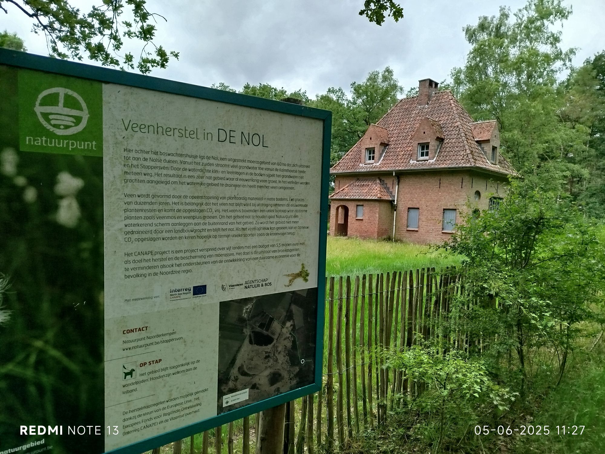
Forester’s house, start/end of the trail. 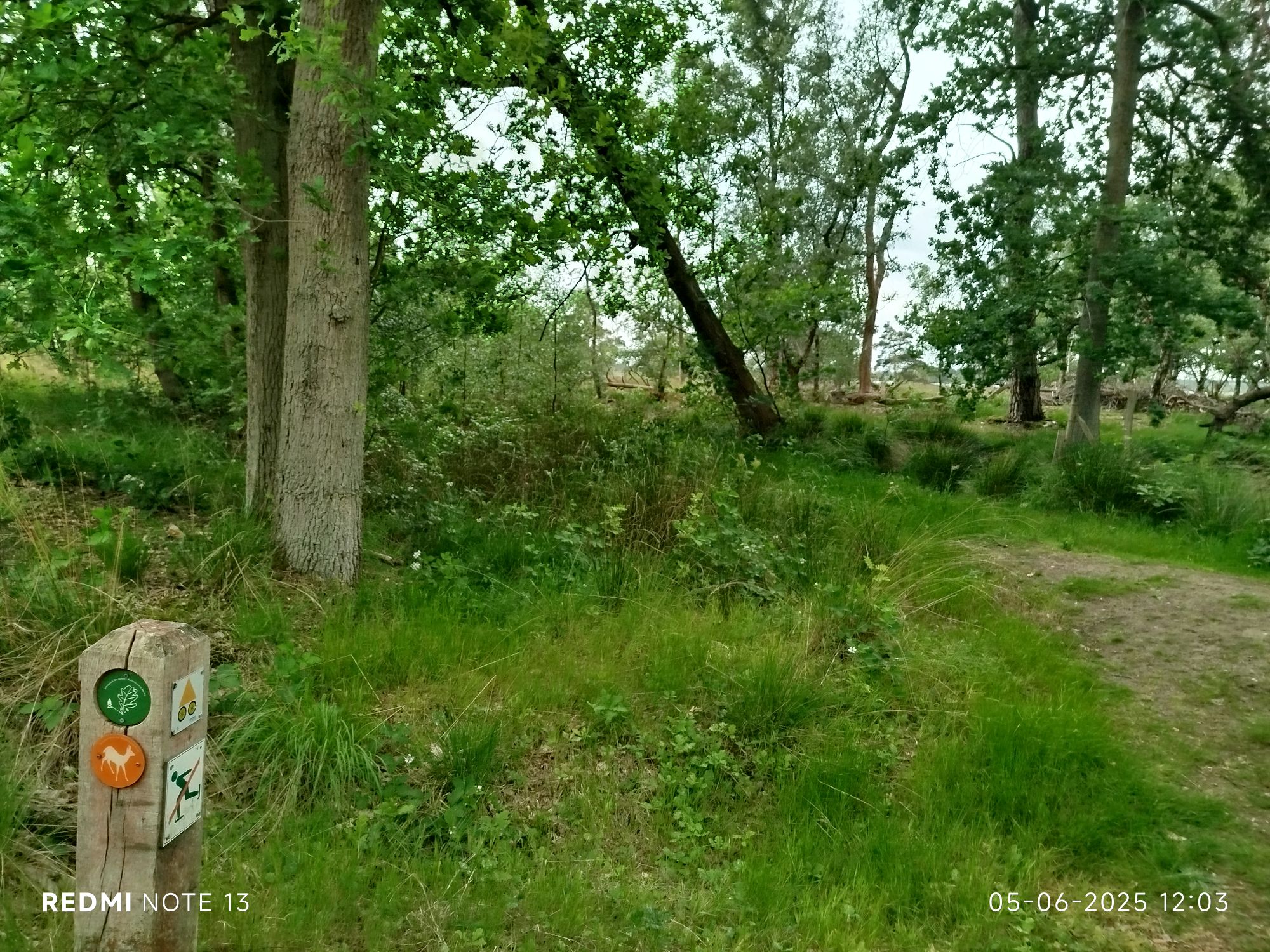
Skating is permitted after the firedept has given their fiat. The fen is not visible in the pic but just a few dozens of meters away. 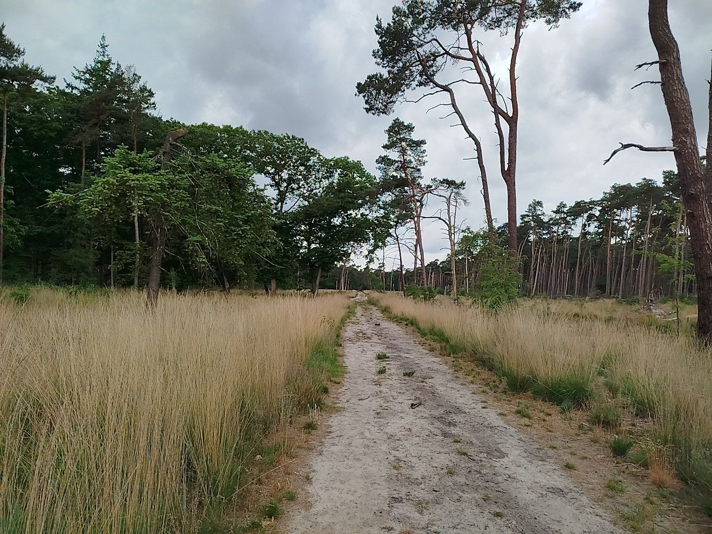
And all of a sudden you may found yourself wondering about the change of scenery. 
This area is – during wet periodes – often completely submerged. 
Fascinating change of scenery from woodland to heathland. Also surprised by the pitchforked path. 
Waymarks, bear in mind not all stand out like this. Sometimes they blend in like a chameleon. 
Watermanagement 
Interesting green spot on the path, water was present for most of autumn, winter and spring. Cycling and motorised vehicles are not allowed here. As you can see some cyclists do not mind. 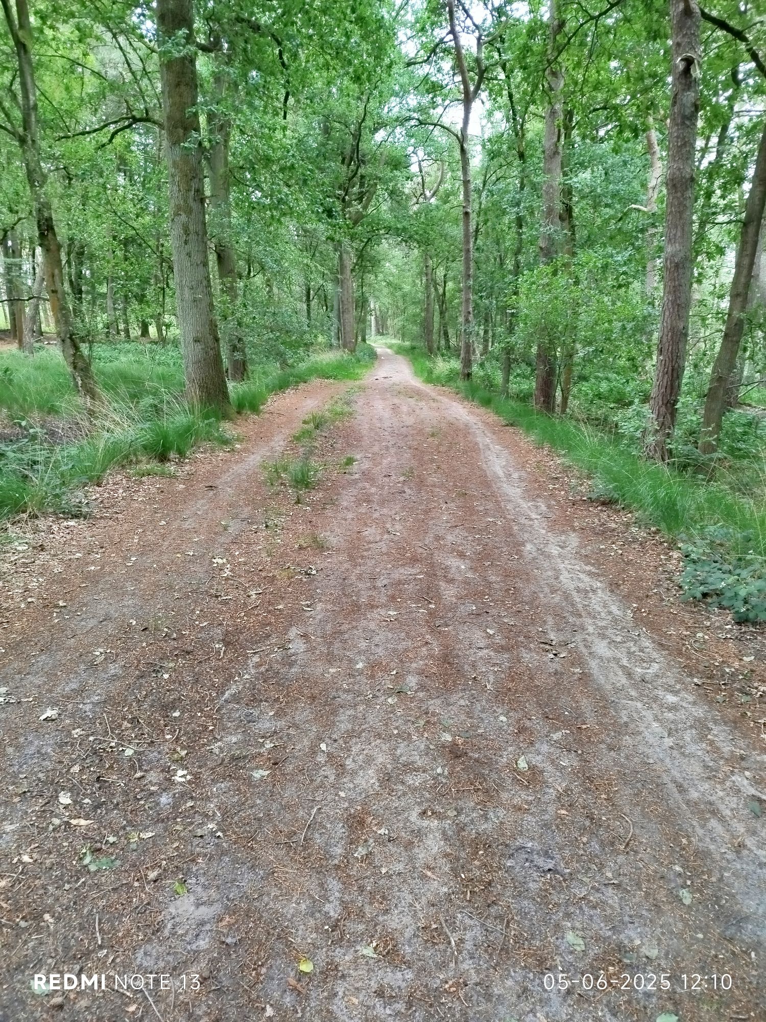
Quite busy path between Huybergsebaan and Stappersven. 
Watermanagement 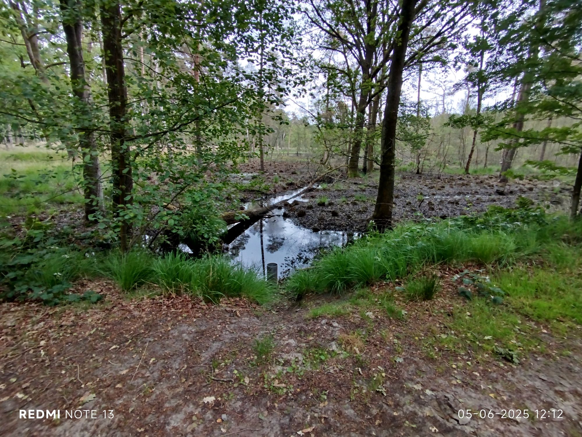
Another low area often submerged. The pipe in the front can be extended upwards. Excess is released on the other side of the path. 
Another weird observation is that people should always wear appropriate shoes. I’m baffled that people create new paths to avoid the smallest speck of mud. 
Peat canal, de Nolse Vaart, indicating the border between the towns of Kalmthout and Essen. The canal links up with another canal and continues to the Dutch city of Roosendaal. The drought is clearly visible. 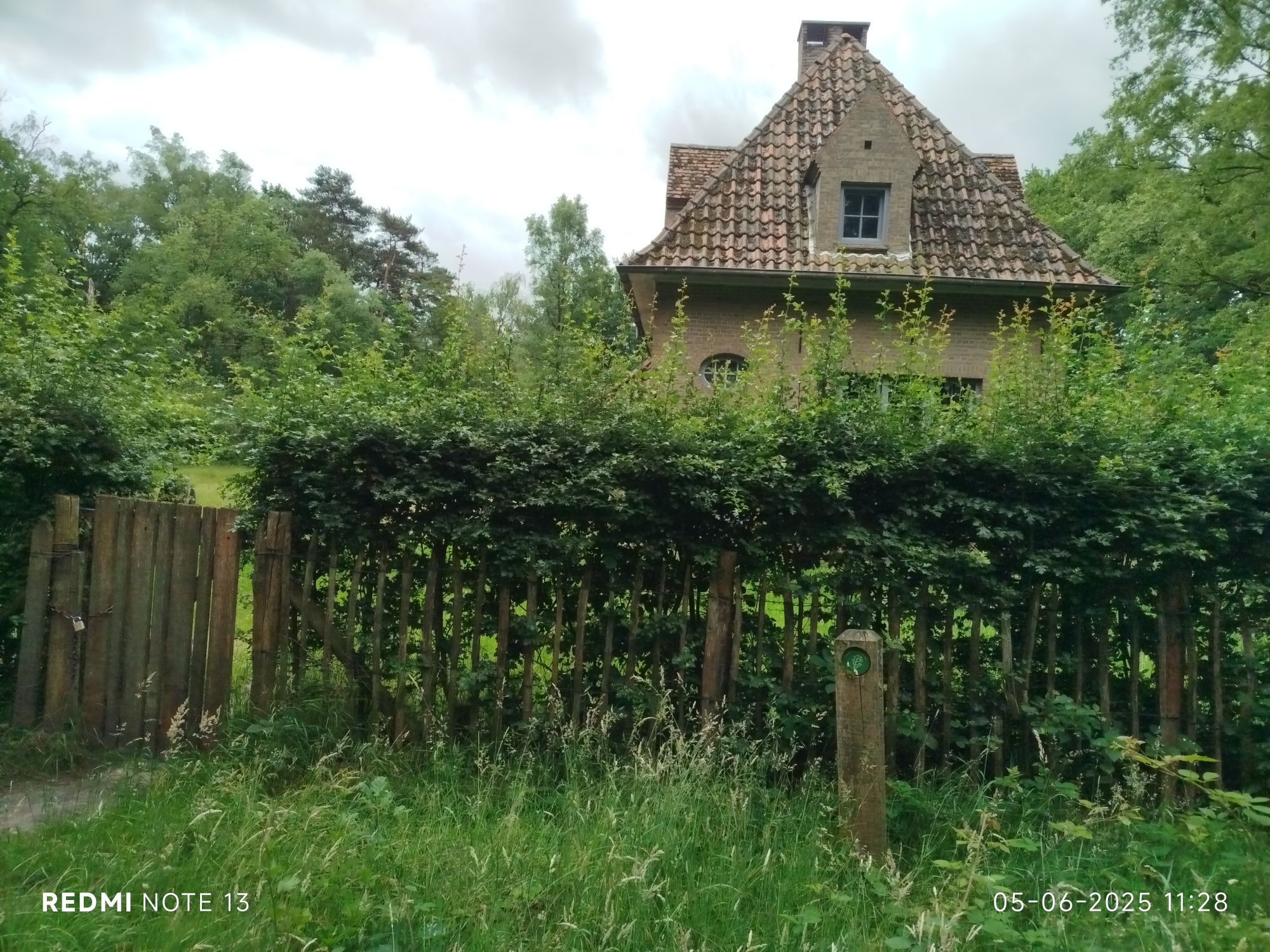
Forester’s House. And to show some signposts are less obvious. This is the actual start of the trail. 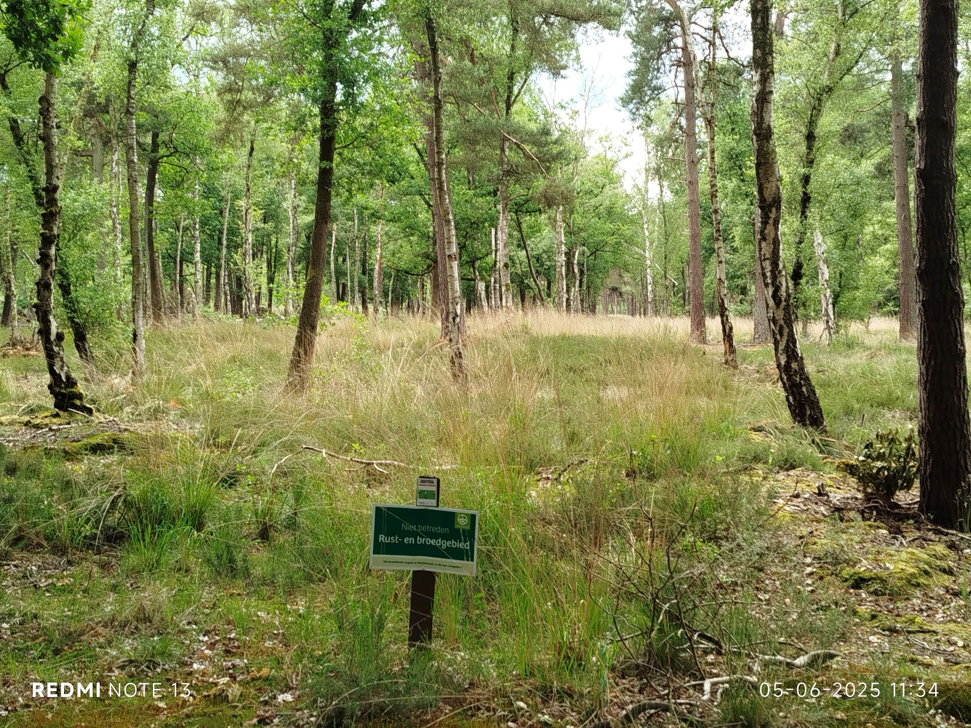
Breeding/resting area, since some visitors fail to understand this is not a zoo but a nature reserve where wildlife is not locked up.
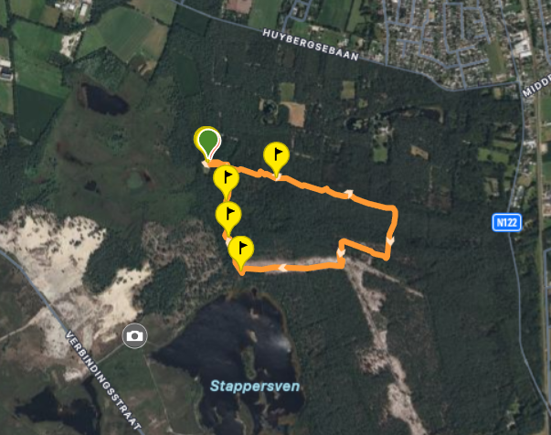
This specific trail does not begin nor end at a car park.
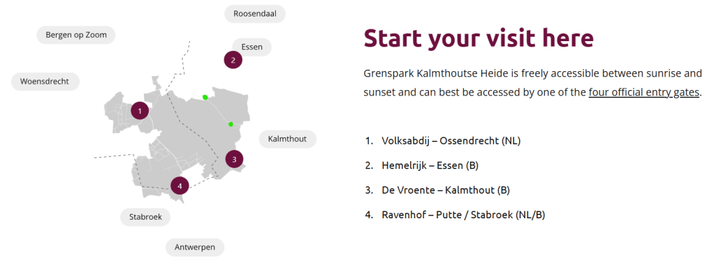
Perfectly combinable with Blueberry trail that is nearby Grenspark Parking South. I’ve placed two green dots on the map (below) to locate (unpaved) parking areas (top one is named Grenspark Parking North) nearest to the Oak trail. Use the southernmost green dot and combine Oak with Blueberry and/or “The Stapper” and other observation towers/platform. If you opt for the northern parking area you will have to walk along the Verbindingsstraat and take a left on the pathway where the camera-icon is located on photo1/14). You can then start the trail at the southwest corner which can be easily located since it has a map of the area and a wooden bench.
Yes, the forester’s house is abandoned and yes, I would love to live there. Sometimes the domain is heavily guarded by sheep. Not sure if I can survive without electricity (just for batteries though).
This was the first of 28 waymarked pathways I will document. If my cartilage damaged foot does not play up. Out of the 28 waymarked pathways, many of those are less than 2 hours to complete.
