Tag: camino

  • Hiking Through Belgium: Nature and History Combined (Lier, Duffel, Boom)

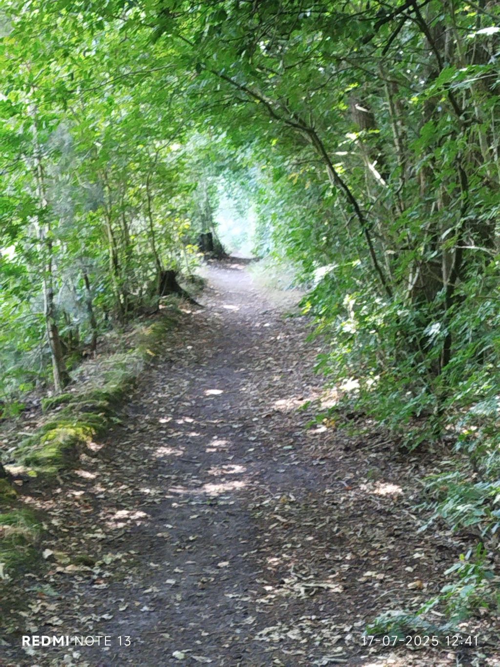
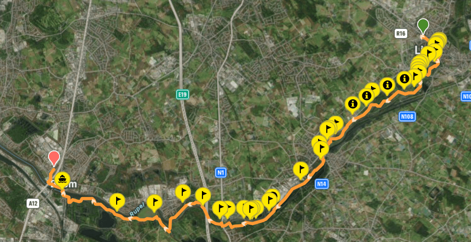
    In preparation of multiple day hiking trips I boarded a train. In the Lowlands we have a concept ‘treinstapper’, take the train to a certain destination, hike wherever you like (mainly parks and greenways – we call them “slow roads” as motorized vehicles are not allowed) and take the train back home. The word ‘treinstapper’ is self-explanatory since the Dutch language loaned ‘trein’ from English and ‘stapper’ entered the English language via Germanic influence.

    Train has a fascinating etymology with different meanings over time.

    I believe it was my first visit to the Medieval city of Lier. The city is linked to (Belgian) Saint Gummarus. The red figure left of Lier is their nickname: sheep’s heads. If you want to know why, read here.
    After military campaigns (and perhaps his wife) he had enough of humanity, I assume. The city grew up around his hermitage. Stories, legends, folk tales can be easily found on the www. Duke Henry 1 of Brabant granted Lier city rights in 1212. Thanks to textile industry many regions in the Lowlands boomed in 12th and 13th century. And then the 80 Years’ War happened, I know, a recurring theme and it was a temporary downfall for current Belgium and the Netherlands. Lier bounced back thanks to their cattle market, breweries and textile factories.
    In 1580s English a lier-by was a mistress. Also no links to the word lyre (lyrical) derived from Latin Lyra which is also the Roman name given to the city.
    A nationally renowned author and poet described Lier as “where three meandering Netes (river) tie a silver knot”. The Big Nete and Small Nete become the (Nether-)Nete.

    I barely took any photos in the city as it was their annual November funfair. This one above is also pretty famous, the Zimmer tower with its many dials.

    Next port of call is Duffel (yes, you do recognize it, don’t you).
    Celtic presence might indicate that the town’s name was given by them, “Dubro” meaning water. Just like Lier, many artefacts were discovered but from times when writing was deemed not important or non-existent. Duffel got immortalized worldwide for the coarse woolen cloth. Or rather thanks to the English language. I don’t see anyone asking for a “duffeljas” (jacket) or duffeltas” (bag) in Dutch shops…

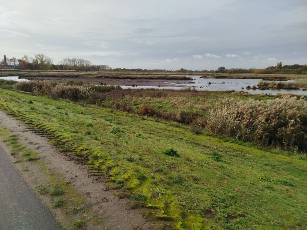
    From the textile industry I venture into brickmaker’s territory. Obviously both requiring a continuous flow of water, the latter also needs clay. Does it surprise anyone that many fishing clubs are present? The many claypits have been repurposed as ponds and nature sites. Plenty of efforts were needed since – back in the day – the pits were used to dump all sorts of trash, including asbestos. The soil is still being monitored.

    And last in line is Boom. Like Rumst, Boom is famous for its bricks. I have written about Boom here.

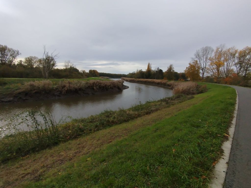
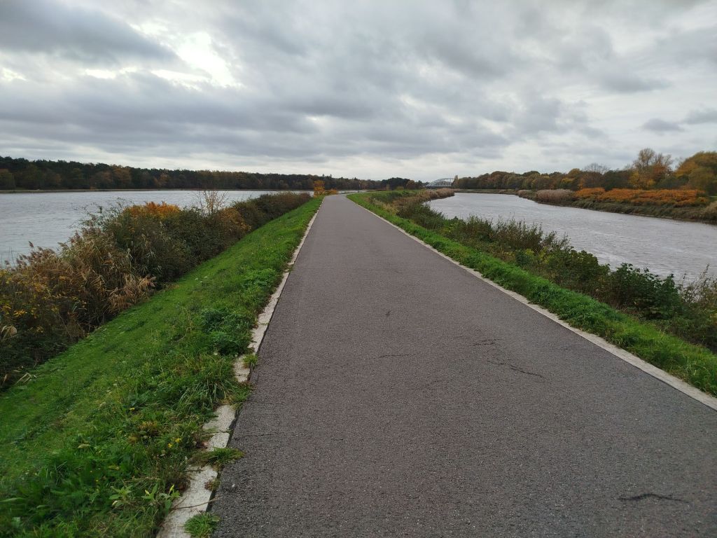
    The hike was just over 15.5mi and I ended up crossing the river by ferry boat (notice similarities with the Dutch ‘veerboot’?). No, the verb to veer is from French. In Dutch we have adjusted veder to veer. In English the word transformed to feather. Neither feather nor veering is relevant. Language and its evolution can be rather confusing but it keeps me occupied on the road. The scenery was stunning though and many areas have been re-designated to flood plains.

    In Belgium we have a saying: A Belgian is born with a brick in his stomache. Just to say everyone wants to build his or her own house. The brickmaker’s industry requires much less (human) manpower and plenty have found out – the hard way – that you simply cannot build wherever you want. A colorful history mixed with life lessons.

    A truly fascinating region wedged between capital Brussels and Europe’s second largest port: Antwerp.

    Additional pics and details: https://nl.wikiloc.com/routes-wandelen/ts-lier-duffel-boom-238811576

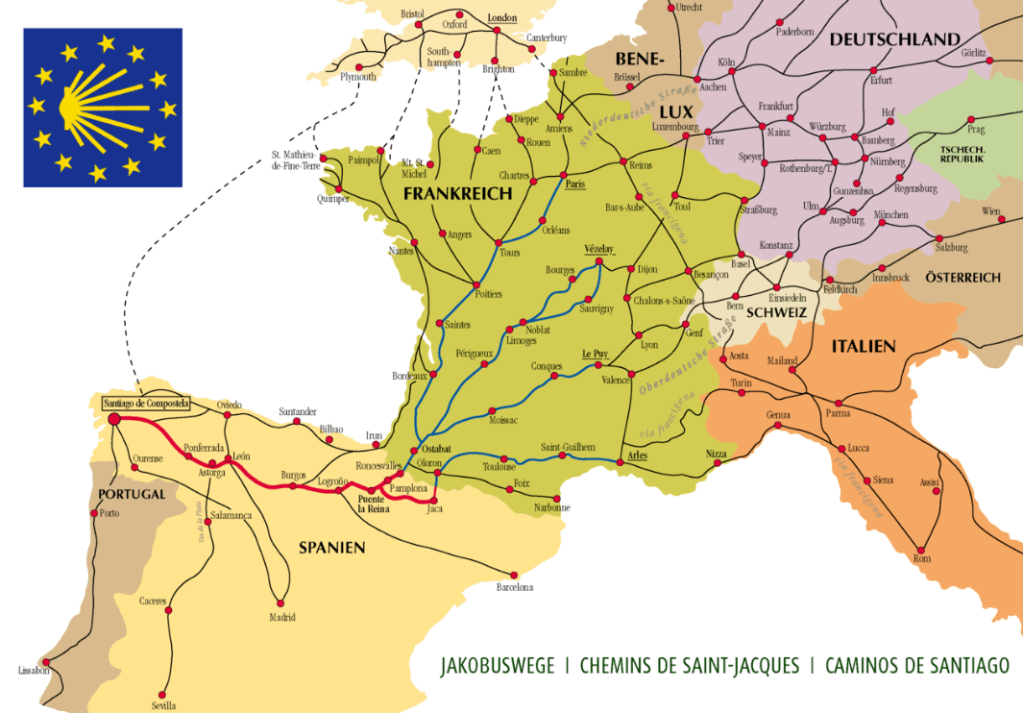
    In case you want to walk the Camino, and opt for Via Brabantica, you will pass by this region (if you choose the original route and not a shortened version).

  • Understanding Desire Paths: Nature’s Shortcuts Explained

    Understanding Desire Paths: Nature’s Shortcuts Explained

    I have been wondering why people create shortcuts in nature. Instead of following the path they walk over vegetation. Why would you even consider doing that? Are you really in a rush when searching for peace and quiet? A toilet? Should everything be fenced off where to walk and where not? I just do not understand this behavior in nature. To point out just one advantage of not walking off trail, less chances to gather ticks.

    Then I found some interesting results and even psychology behind it all.

    In cities people are oftentimes (read: always) in a hurry. Cities equal time = money.

    A desire path or desire lines have a very long history.

    Animals create these lines as well. You will probably have seen the paths created by hippo’s, (or elephants or cattle). Funny how the English language still holds on to the Latin word (‘river horse’). If you wonder where behemoth comes from, well, it’s the Russian version. In Germanic languages it got translated into “Nile horse” and South Africans call it a “sea cow” (not sure if “sea horse” was already taken).

    The hippo trails had a specific purpose.

    Back in the day, like centuries, people took the paths with least resistance. In my region a new church was built because people of a nearby municipality had to walk 7 or 8 miles to the nearest church. Oh no, not the distance was the problem but wolves. And then I wonder how many proud parents and babies got attacked before the Catholic church decided to protect the parishioners. In the 16th to 18th century wolves were hunted nationwide. Only now they are slowly returning into some regions thanks to the protected status of wolves.

    In Europe, many places near rivers have names that nowadays translate into “shallow place to cross river”. In Dutch language you will often hear/read place names ending on -voorde, -foort or -drecht, -dracht, -trecht, , -tricht, -tracht or wad (like the Frisian Islands north west of Amsterdam and are dotted along the shoreline over Germany to Denmark, those islands are worth a story on itself). In Germany you will notice plenty of -furt (Frankfurt) or -ford in English (Stamford, Oxford). Yes, it is derived from the Nordic fjord.

    The first roads were actual desire paths. The safest, shortest, easiest way to go from point A to B. Much depended on the environment. Obviously, back in the day, safety was rated more important than shortest. You rather want to reach your destination than be earlier with a risk of Russian roulette or knee-deep covered in mud.
    It was only when the Romans started building their roads, for military purposes primarily, of course, that cities became more easily accessible. Civilizations before the Romans already had roads so the Romans did not have to do much more in the department of planning. That Roman network is actually still in use. Not all of the cities are still that important and certainly bigger cities exist that were hardly villages in the Roman era but it might provide an indication why European road network is not as organized as in the USA. In the US settlers could basically start from scratch. Hence why you will not easily find numerical street name in Europe.

    Street, roads, etc were named geographically. The main hiking trails are often a description of the area or the destination (pilgrimage), etc. People used to walk longer than we have motorized vehicles. And yet, I am so surprised people hike in nature with white sneakers. You must remain classy and elegant for wildlife, right?

    Also, interesting is why the Romans called the Irish “Scotti”. Did the Romans not call Ireland “Hibernia”, land of winter? It were certainly not just the Normans who marketed their new territories ‘Ice’-land and ‘Green’-land for no reason whatsoever. Funny and fascinating how we are still unclear about so many names and etymology.

    For Americans the most well known desire path is Broadway (aka Wecquaesgeek trail). In Europe I assume we have to look towards the famous Camino de Compostela.

    Are you surprised the Camino Francés (The French Way) is more than 1000 years old?

    I just realized only one route is listed on the map above. In Belgium alone we have eight major ones, even more if you count “shortcuts” to current public transport, mainly linking up to railway stations.
    From left to right: Via Yprensis (Ypres), Via Brugensis (Bruges indeed), Via Scaldea (river Scheldt), Via Tenera (Latin version of Celtic ‘Tanare’ = dark water, follows the river Dender), Via Brabantica (through Duchy of Brabant), Via Lovaniensis (through Leuven; university city and home of Anheuser-Busch Inbev HQ), Via Monastica (even more monastic POI on route, those familiar with abbey/trappist beers and cheeses: Postel, Tongerlo, Leffe, Averbode) and finally Via Limburgica (most Belgians don’t appreciate the area or people with the respect they deserve, but hey, their loss, right).
    Obviously all the routes are a string of monastic/religious places. Nowadays you can also bike the compostela.

    It is quite amusing when Americans come to Europe and are surprised by how small everything is. Perhaps not realizing it – sort of – naturally evolved. Cities are centuries old and cannot easily be dismantled to accommodate to modern traffic. Therefore many major cities are banning motorized vehicles from city centers. Also focusing on public transport. Why not question the reasoning behind US city not being able to implement more eco-friendly transport options?
    Some cities are car-free, some have low or zero emission zones. Why rent cars and – besides not understanding every European country has its own traffic rules – don’t know many areas are not accessible by car.

    Some examples show insights as Ohio State University. only when the desire paths became obvious they paved the way.

    Sometimes authorities even legalized cases whereby locals painted pedestrian crossings (in Dutch zebra path; BE: zebra crossing). And because of their success, authorities made them official.

    In nature straight lines are not common. To avoid danger (water crossing, wildlife, or treacherous areas) routes were rarely direct lines.

    It were the Romans that started straight roads. Probably they also had the notion that curves and corners meant waste of time. Before Roman roads travel was extremely adventurous. Pretty unimaginable for most of us nowadays. Certainly since our parks are often cleaned up for aesthetic reasons. Luckily most do understand that death is life. Like death wood is a life source for many bugs, the bugs attract birds, etc.

    Walking distances would vary significantly. Most hikers will consider plenty of factors to estimate pace or distance.
    History learns us that Harold Godwinson won a war in the north. Moved south to deal with Norman invasion, meaning 200mi in a week (abt 27mi/d). This was well after the Romans built their network but I assume one thousand years ago they did not have the best of footwear.

    On the other hand water also finds the path of least resistance and changes trajectories. Human activities does not follow nature’s pace of life. Then again, water can carve out mountains.