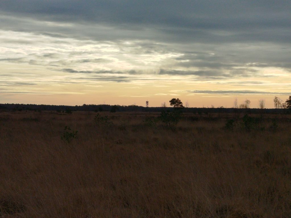
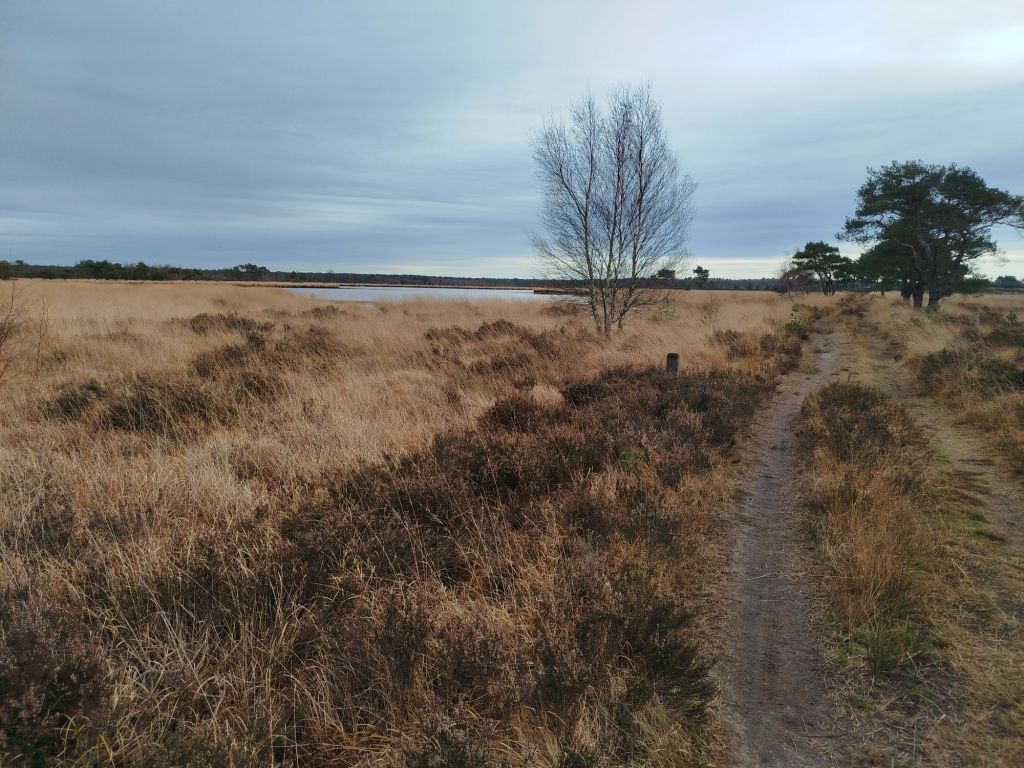
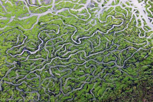
Early to half December and I was hiking in a shirt. The fens were about as dry as during high summer. Groundwater levels still need plenty of rainfall.
The construction in the center is an observation post (locally known as fire tower). At almost 140ft high two platforms (40 and 80ft) are open for public. The top floor is reserved for volunteer observers and equipment. Earlier this year cameras have been installed with AI to detect wildfires at the earliest stages as far as 20mi away.
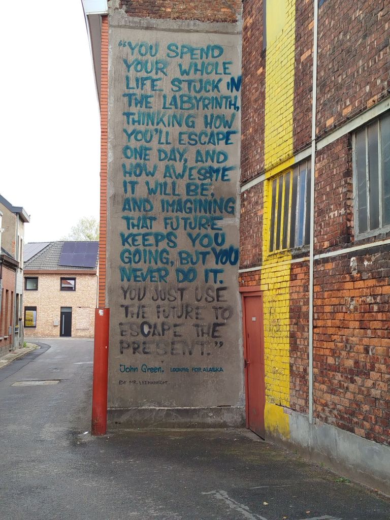
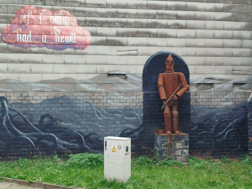
Can you tell Vincent van Gogh was from this area? Or is it my imagination linking the Dutch painter to this natural phenomenon. If Vinny was still around it might even be attributed to him. Like Banksy’s being created overnight. Surely pumpkin spice is not that popular in the Lowlands, is it?
I walked a portion of the border. These old, stone border markers are still present.
The newer ones are painted black and white and have a date (1843) and number on them. This path was probably created by border patrol. On some sections left and right aligned with barbwire (some are either private property, hunting grounds or to protect vulnerable areas). Obviously smugglers would not “walk the line”. In order to preserve nature, walking the pathways is mandatory. If you desire to rebel, have the balls to punch up, not down!
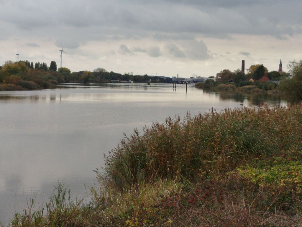
This specific fen (Kriekelaarsven – Bird-Cherry Fen) used to be much larger.
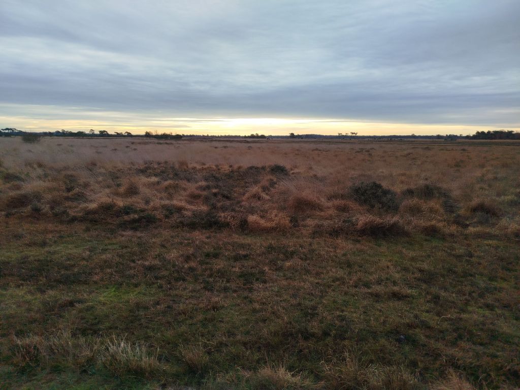
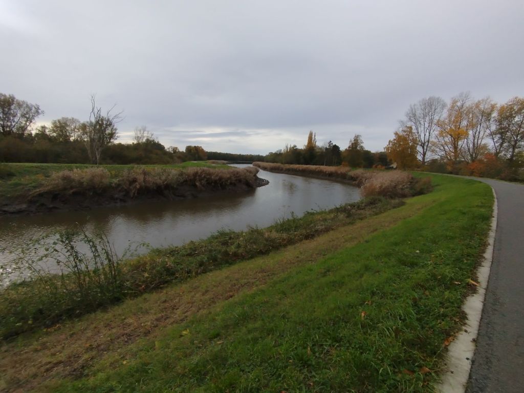
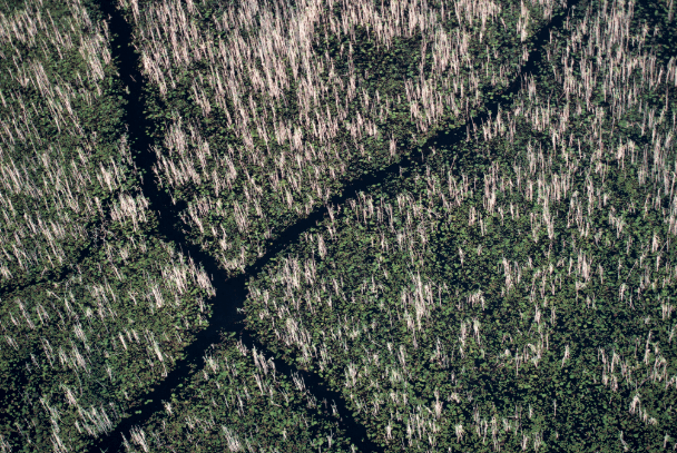
Tomorrow I plan to hike the three largest fens in the park to document the water levels. Stappersven, almost identical in English so I assume you can deduce, is the largest and on my last visit, you could walk about 30ft from the shoreline without getting wet feet. The other, Putse Moer (Marsh of Putte, which is a place name) was partly dried up. The third is Drielingvennen/ Klein Moerken which translates as Triplet Fens or Small Marshy. It consists of three separate fens that often become one large fen.
In preparation of multiple day hiking trips I boarded a train. In the Lowlands we have a concept ‘treinstapper’, take the train to a certain destination, hike wherever you like (mainly parks and greenways – we call them “slow roads” as motorized vehicles are not allowed) and take the train back home. The word ‘treinstapper’ is self-explanatory since the Dutch language loaned ‘trein’ from English and ‘stapper’ entered the English language via Germanic influence.
Train has a fascinating etymology with different meanings over time.
I believe it was my first visit to the Medieval city of Lier. The city is linked to (Belgian) Saint Gummarus. The red figure left of Lier is their nickname: sheep’s heads. If you want to know why, read here. After military campaigns (and perhaps his wife) he had enough of humanity, I assume. The city grew up around his hermitage. Stories, legends, folk tales can be easily found on the www. Duke Henry 1 of Brabant granted Lier city rights in 1212. Thanks to textile industry many regions in the Lowlands boomed in 12th and 13th century. And then the 80 Years’ War happened, I know, a recurring theme and it was a temporary downfall for current Belgium and the Netherlands. Lier bounced back thanks to their cattle market, breweries and textile factories. In 1580s English a lier-by was a mistress. Also no links to the word lyre (lyrical) derived from Latin Lyra which is also the Roman name given to the city. A nationally renowned author and poet described Lier as “where three meandering Netes (river) tie a silver knot”. The Big Nete and Small Nete become the (Nether-)Nete.
I barely took any photos in the city as it was their annual November funfair. This one above is also pretty famous, the Zimmer tower with its many dials.
Next port of call is Duffel (yes, you do recognize it, don’t you). Celtic presence might indicate that the town’s name was given by them, “Dubro” meaning water. Just like Lier, many artefacts were discovered but from times when writing was deemed not important or non-existent. Duffel got immortalized worldwide for the coarse woolen cloth. Or rather thanks to the English language. I don’t see anyone asking for a “duffeljas” (jacket) or duffeltas” (bag) in Dutch shops…
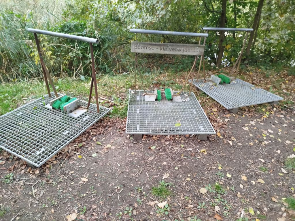
From the textile industry I venture into brickmaker’s territory. Obviously both requiring a continuous flow of water, the latter also needs clay. Does it surprise anyone that many fishing clubs are present? The many claypits have been repurposed as ponds and nature sites. Plenty of efforts were needed since – back in the day – the pits were used to dump all sorts of trash, including asbestos. The soil is still being monitored.
And last in line is Boom. Like Rumst, Boom is famous for its bricks. I have written about Boom here.
The hike was just over 15.5mi and I ended up crossing the river by ferry boat (notice similarities with the Dutch ‘veerboot’?). No, the verb to veer is from French. In Dutch we have adjusted veder to veer. In English the word transformed to feather. Neither feather nor veering is relevant. Language and its evolution can be rather confusing but it keeps me occupied on the road. The scenery was stunning though and many areas have been re-designated to flood plains.
In Belgium we have a saying: A Belgian is born with a brick in his stomache. Just to say everyone wants to build his or her own house. The brickmaker’s industry requires much less (human) manpower and plenty have found out – the hard way – that you simply cannot build wherever you want. A colorful history mixed with life lessons.
A truly fascinating region wedged between capital Brussels and Europe’s second largest port: Antwerp.
In case you want to walk the Camino, and opt for Via Brabantica, you will pass by this region (if you choose the original route and not a shortened version).
Almost a month into autumn and nature looks the same as mid August (caused by heat stress). It has rained just a little, not even enough to create puddles in what used to be fens. In a few weeks I hope to show you another photo with the fen as it is supposed to look like.
I presume park management was already putting up “do not skate” warnings this time of year some thirty years ago.
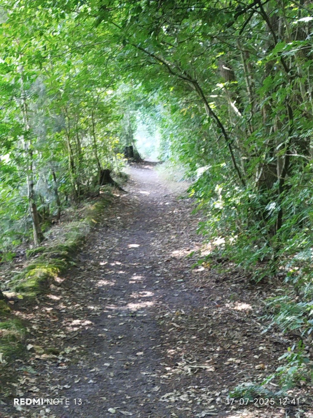
This morning I decided to combine 4 short trails: Dragonfly trail, Caterpillar trail and Forest trail, plus Butterfly trail completely. Totaling just over 5.5miles
ForestDragonfly and CaterpillarButterfly
I started my tour at a bike parking next to “Den Doodendraad” (death wire), commemorating WW1.
Dragonfly info sheet (Celtic.Belgae style)
The Dutch “libel”, is from Latin libellula, meaning a certain insect. It is also the diminutive for libella which translate as level (horizontal) and the diminutive of libra, also level or scales (i.e. zodiac). 16th Century biologists named the creature since it looked like their equivalent of a level. The English ‘libel’ is also from Latin ‘libellus’ meaning something like “little book, pamphlet, written accusation, etc”, the current meaning “false or defamatory statement” is from 1610s, the legal sense is first attested 1630s.
Yes, English is a Germanic language with Nordic/Norman and French (read: Latin) influences. Quite equal to Dutch however the Vikings were not so interested in our swampy heather fields as they were all but ideal for farming. Latin definitely was quite a difficult language. Dragonflies have been – mainly hovering – on earth for about 300 million years and are quite prevalent in our park they are facing extinction due to climate change, wildfires and drought. Having survived several mass extinctions, a human made one might be their swan song. According to IUCN Red List of threatened species more than 48,600 species are threatened with extinction… Yes, read that again and please. Please do not hesitate to do whatever you can: contribute, educate, organize litter collection parties, etc
Butterfly
At the refurbished visitor center De Vroente, starts another quite unique hiking trail for the visually impaired: Butterfly. In the visitor center you can also borrow simulation glasses and walking sticks.
A dry fen
The whole trail has those logs as guidelines. I hiked the trail earlier this year in Feb. Due to excessive rainfall the trail was barely safe for an able bodied person: I remember ankle deep in mud, slipping and tripping. However the path is generally well maintained. I don’t assume the path is daily maintained though.
Butterfly fact sheet (aye, my style)
In Dutch we call it a “vlinder”. Quick study shows the lowlands had a multitude of dialect names per region. The oldest written source (1397) calls it a “capelle” (like chapel). Derived from Middle Latin “Cappa” (= cape) but got in disuse with the popularity of “vlinder”.
Dutch writer Multatuli also named them “kapel” in 1870. Some dialects even named it ‘summerbird’ (like in Nordic languages) or even ‘owl’ (initially just for moths, what we call night “vlinder”) but also some onomatopoeia variants. The local names rapidly decreased in the last 50 years.
Seems like butterfly is one of those animals that does not have a common name. I mean many regions already had their name for it. I don’t see much overlap;
Albanian – flutura (some Belgian dialects also had the “fl” sound)
Amharic – birrabirro
Anglo Saxon – fifoldara (imagine using this, more poetic word, instead of butterfly)
Arabic – faraasha
Cheyenne – hevavahkema
Farsi – parvaneh
French – papillon
Gaelic (IE) – féileacán
Gaelic (SC) – dearbadan-de
Galician – volvoreta
Italian – farfalla
Rwanda/Burundi/Suaheli – ikinyugunyugu
Aztec – paplotl
Spanish – mariposa
Tiwi – kwarikwaringa
Turkiye – kelebek
Welsh – iâr fach yr haf (literally “little summer hen”)
The English caterpillar comes from French “chatepilose”, literally “shaggy cat”. Funnily, the Swiss Germans call it “devil’s cat”, some refer to a dog and the Portuguese even “lizard”. In Germanic languages a (boring) variant of “rups” is in use. Not dozens of poetic names like the previous.
The Caterpillar Trail is another unique one since it offers physically impaired people the opportunity to (re)discover or relive past experiences or memories in the heather fields. The visitor center provides an electric all-terrain wheelchair if needed.
Forest
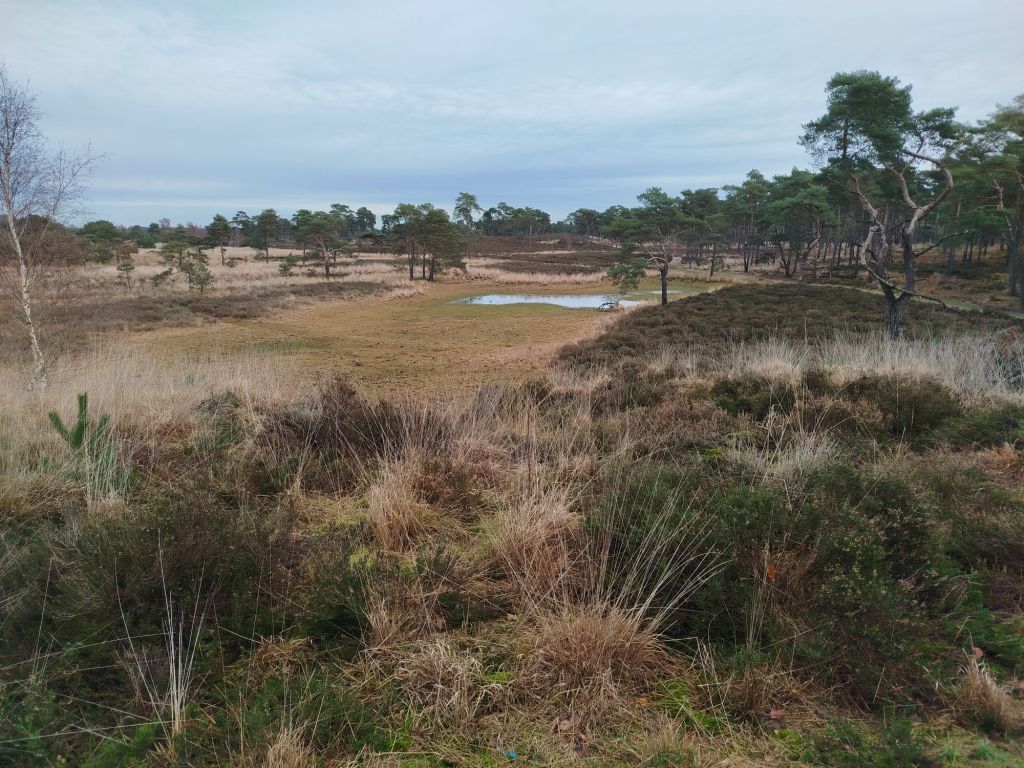
Mixed feelings about this one. Forest trail will be very challenging (and fun to hike) in winter and especially after extensive rainfall. Unfortunately the fen Putse Moer was still mainly empty as top photo proofs. Most of the forest is pine and not specifically local. These were planted throughout the region. Not sure if all pine trees were suitable but they were used in mining. Apparently these beams creak big time giving you ample time to flee before the roof collapsed. I assume not many people wonder why these trees are present. Nobody will be surprised the landlord sold the story as “I gift you a forest” and neglected to inform them it is an investment, not so much for amusement.
Dragonfly
At about the Putse Moer, where I took the first picture I connect to the Dragonfly Trail. I already started to wonder if all winged insects are called something -fly in English. It is just a coincidence I combined dragonfly and butterfly trails.
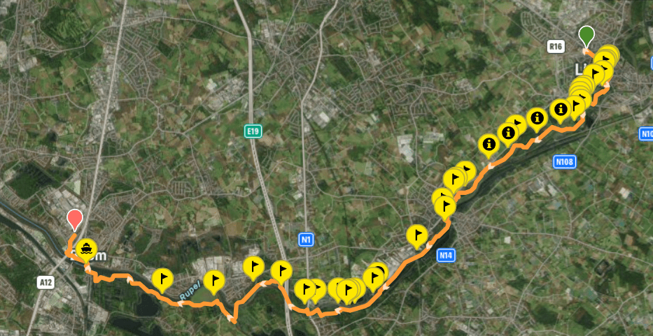
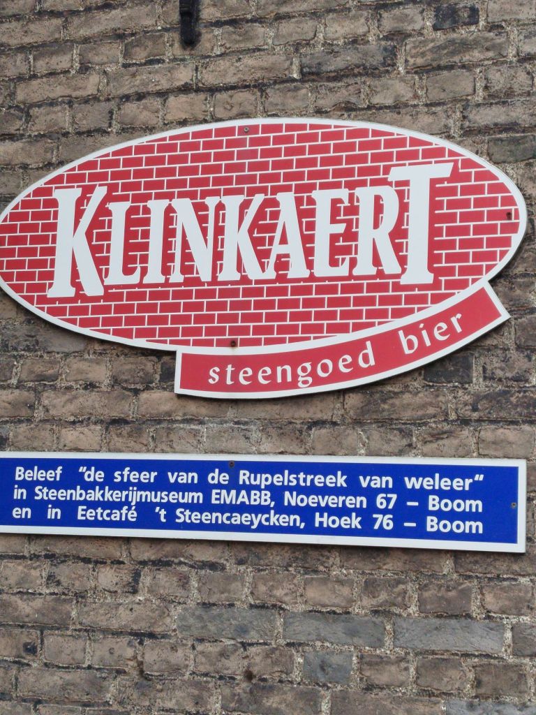
Today I visited a town many will recognize for its festival: Tomorrowland. Is it a coincidence it is organized in Boom? For those into (European) football, Romelu Lukaku played his first official matches in this town. Location-wise the area is close to the confluence of the rivers Rupel and Scheldt, in the triangle Antwerp, Ghent and Brussels.
As an etymology enthusiast, the Dutch “boom” translates to “tree”. The English tree comes from the “visit” England got (once upon a time) from ‘the Vikings’. You may realize that in English you use your version of boom but anglicized it to “beam” which is from Germanic origin. What the English now understand for the word “boom” is an onomatopoeia. Started when bombs were introduced and boomed.
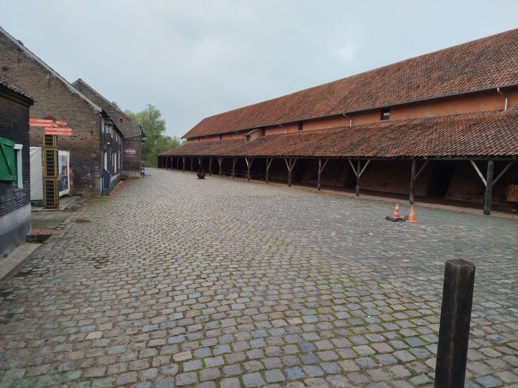
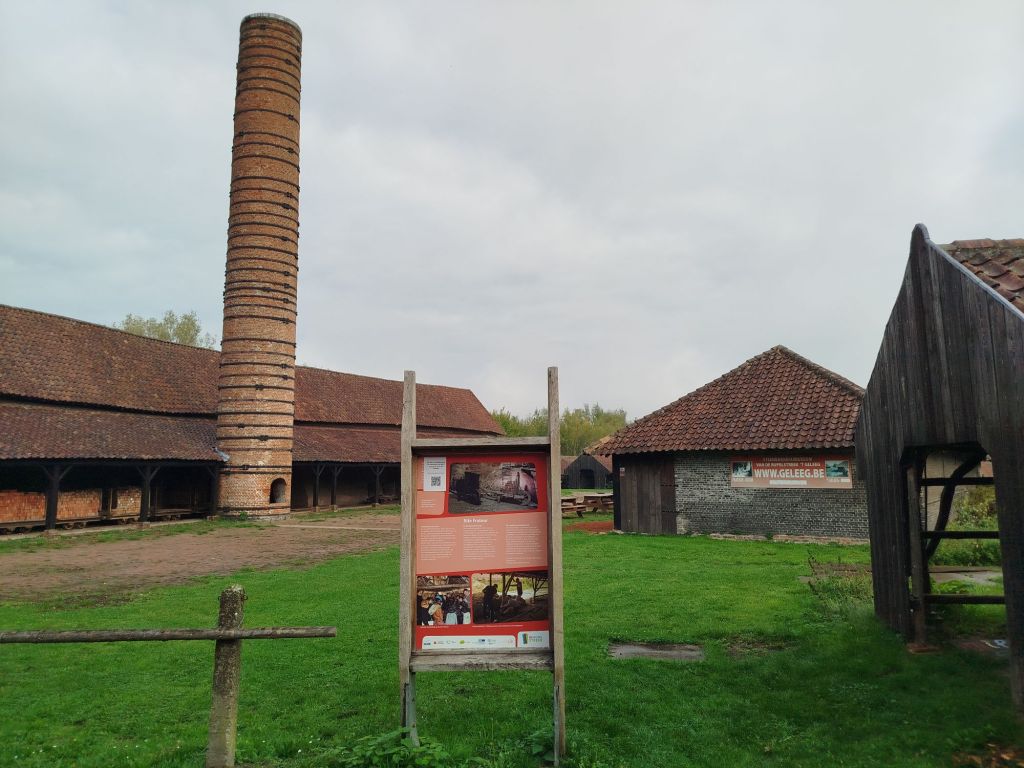
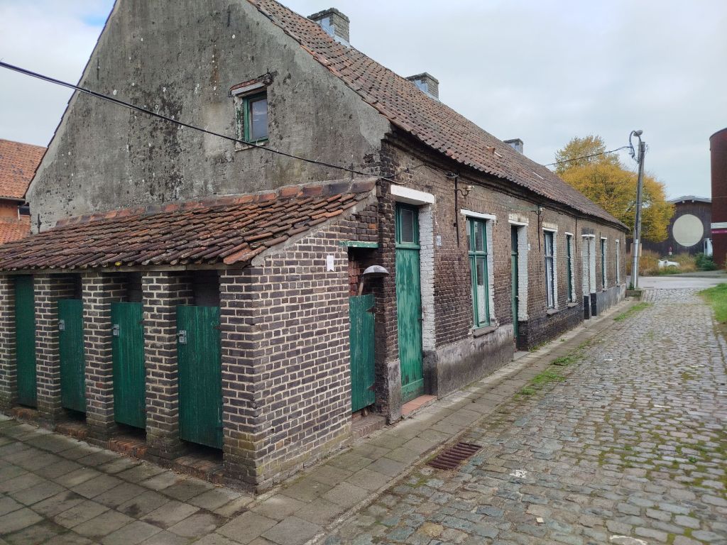
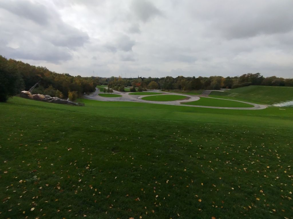
The hike is called Rediscovering Brickmakers’ (in Dutch we call it stonebakers) Tunnels. Not even so far from my home, I was pleasantly surprised the hike was not completely flat terrain. If you want to check out the hiking details, click here. Surprisingly the festival ground is literally noticeably on higher ground and once a year (oh you read my mind). Perhaps you have seen photos or vids of the festival, resembling a Greek theater lay-out.
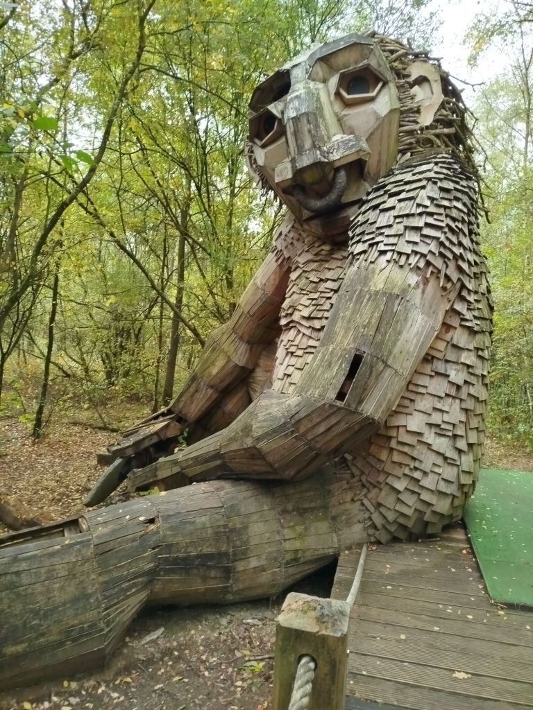
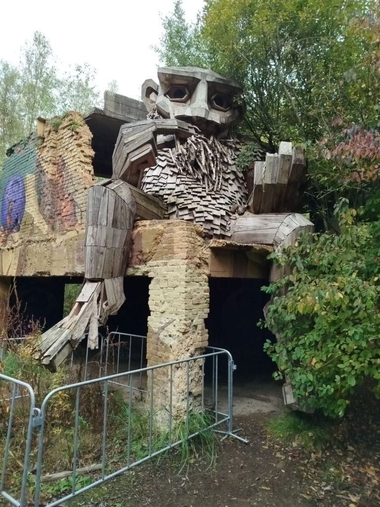
These creatures (trolls) can be found in the provincial recreation domain The Schorre, where the festival ground is. Seven of them are playing in the Troll forest. My hike only revealed 4.
Visitor center Brik BoomBrickmakers museumBrickmakers houses with outhouses on the leftReminds you of clinker? As in the meaning of a paving bricks not the “stupid mistake” meaning as US-English believes.
I believe I passed three brickmakers sites. They were not open when I visited though but the bars were as of 10am on a Thursday. Funny advertisement for Klinkaert, apparently “stonegood” (synonymous to Dutch stoneware, perhaps you recognize good and goods) beer.
Here is the festival grounds, with the two trolls probably trying to find Ursa Minor. As mentioned, it resembles a Greek theater. The slope itself is not so obvious but perhaps you can put it better in perspective with the stairs on the right.
One of the claypits in WalenhoekYou cannot smuggle Boom’s clay home, these are located at The Schorre
What about a view of Boom next to the river Rupel?
Oh, and of course a town with many international visitors on a yearly basis has some pretty fascinating artwork:
Disclaimer: I am not profiting from the post I make. I just share my experience of this hike. Although I visited many festivals, this was my first visit to this town ever.
Oh, in case you were wondering, the tunnels are dotted all over however most are no longer in use. They are numbered and named per brickmaker factory.
Belgium has a coastline? Aye indeed, just a small strip of 40mi (65km) wedged between France and the Netherlands.
Perhaps I need to translate “kustgemeente” as coastal municipality. Coast is one of those words that is similar in many languages (costa, côte, kust, cuesta, küste, etc). I was quite amazed to learn “polder” is etymologically of Dutch origin. Unsurprisingly since the region is called the lowlands, sparsely populated for quite a long time, even the Romans were not overly interested in an area often flooded and vulnerable.
For most Belgians a trip to our nation’s coastline feels like being abroad. It is quite easy to distinguish dialects and the local one is the hardest to understand. Also, since school had restarted, most tourists spoke French and German. Interesting anecdote, when I was greeting people on my hikes I often chose for “good day” variants since the Dutch, Belgian and German tourists would understand. When it was not reciprocated I assumed they were either grumpy or French. I even adjusted language, wording or expression based on the location. Certain areas are predominantly visited by French tourists so then I was more successful with an “allo” or bonjour. In Dutch many people will ignore a greeting like hello or hi. A nod or raised hand has more success. Yes, this was one of my casual social experiments I conducted on my trip. In cities and crowded areas I was solely focused on rushing to the next nature path.
As I hiked the coastal path for the second time although in opposite direction. Whenever you tell someone in Belgium you have walked the coastline they are usually unimpressed as many claim to have done so. Well, they don’t exactly know what a GR is and say they have one season been to this area and walked from one town to the next one the beach. Their opinion changes when you explain the GR is not just a stroll on the beach but includes many parks, dunes and woodlands.
Translation: rehabilitation of Newport’s witches (recognize “hex“?) On 30 June 2012 all of Newport’s victims, who ended up on a pyre during the witch trials, were posthumously cleared from all blame. “We bow our heads and ask forgiveness”
Quite interestingly these trials were initiated or organized by Christianity. It only took 400 years to repent. The city’s best known witch is “Jeanne Panne” (born De Deyster), notice how her father also burned at the stake 47 years earlier. Some people or even families who were not much liked or some kind of special (specific, unconventional knowledge) or perhaps just seen as a threat to their status or power could easily become targets. Kind of reminds me that certain nations are now designating an “ideology” as a national threat. Witch hunts are of all times.
As an intermezzo I will add some pics of art along our coastline:
A selection of hikes I walked:
How about some scenery?
the sun will set in a few pics
windswept
In the distance is France
During storm Amy, the first of the season
A flushing bassin
In the penultimate moments I got offered this phenomenon.
Nature organisations are working diligently to restore nature along the coastline. The area originally did not have (many) trees. Many (often exotic) plants and trees “escaped” peoples gardens. Many areas are being “reduned”. Many areas are fenced off for wildgrazers, whilst in my region sheep, goats or Galloway’s are to be expected, in the coastal region you will more often spot donkeys or specific cattle.
From the North Sea, or more specific due to import, we got an invasive sea snail species from North America, the Crepidula fornicata, in Britain known as ‘common slipper limpet’. I was amazed to find it on our beaches as I had never seen these before. Originally the snail was from the western Atlantic region. They were accidentally introduced in the eastern Atlantic via oyster import to England in 1870. Nowadays they are to be found all over the North Sea as well as the Mediterranean and even in the Pacific. I guess it is all in the (Latin) name on why they populate practically worldwide.
Trees are important however dunes protect coastal areas from rising sea levels. Interesting fact is that Sea Beggars created the Ostend Creeks when they broke the dykes to protect themselves from the Spanish Armada. Another fun fact is that current Belgium was then also part of the Netherlands hence “Dutch rebels”. Also, these beggars were actually the local elite that were stripped off their wealth by the Spanish. Worth noting that the path has been expanded since it was created. My hike was not 8mi but almost 10 (15,5 instead of 13km). If my memory serves me right, it now consists of 3 loops that can be combined. Bear in mind a bus ride is necessary as the coastal tram does not pass nearby the trail.
In summary, I managed to hike about 186mi (300km) excluding shopping trips and getting to starting point and back. However I also succeeded in deleting my longest hike and failed to register another due to dead batteries. Since I was unable to charge my batteries daily or leave my powerbanks to charge in public facilities I often went to sleep when too dark to read (over one thousand pages read).
Being on a solo trip without unlimited access to electricity changed my perspective on priorities. My smartphone was only used to register hikes, check weather and emergencies. The trip was a test run for Pieterpad, Netherland’s oldest and most iconic long distance path. I got 90°F (32°C) but also 56mi/h (85km/u) storm winds. Though the nights were never cooler than 50°F (10°C). Not sure on how to solve the battery issue on week long hikes. I really want to register my hikes. I’d really hate to have to ask to charge my phone during stops. And buying a dozen powerbanks is sort of ridiculous, no?
These hikes were sometimes with walking poles and always with backpack 11-22lbs (about 5-10kg). Some even without hiking boots on the beach when I searched for seashells for my nieces. Oh, also worth mentioning I did manage to suffer two giant blisters on my heels on just the second day. Unfortunately I forgot I had not walked in my low hiking shoes for months and not even walked in my custom orthotics. Now I am going to make a seashell wind chime/dreamcatcher.
Waking up at 1.30 am is not my normal routine. I am always jittery before leaving my comfy safe space, even for a holiday. Also, the drunk people singing/howling outside did not exactly help my sleep. Exit summer parties…
Something absurd like perfectionism kick-starts my brain while it should dormant for a few more hours. Mulling over the to-do list and pondering worst case scenarios (my brain’s favorite pastime, it appears), I realized staying in bed was no longer an option.
Rest assured not all will be meticulously prepared. Murphy manages to surprise even the best perfectionist, trust me. Not claiming to be the best perfectionist though. Or perhaps everyone agreeing with this statement lacks a specific crucial trait.
The early morning does help to quietly and calmly perform the checklist and even plenty of time to clean out fridge and unplug it. Also an early fall (I prefer the French term autumn) cleaning might be on the agenda with still time for a siesta before traveling.
Already managed to research some of the folklore of the Belgian coastline. However much focus is on world war history. I found a witch trail. I will have to ignore a shrimp fest (allergy, scampi used to be my favorite food), exclusive car and old timer events and a flower parade (during peak season).
One of the POI is Lissewege, according a 2007 national tv show one of 50 most beautiful villages in Flanders (pic below, aka “the white town”). I will visit at least half of the top ten of the provinces nominees. The village name is quite old and some may believe it to be related to a plant “fleur de lis”. And “wege” resembles a current term for “road to”. Wegha is actually a Frankish term for “house”, and “Liss” being a proper noun. In the Netherlands they have the town of Lisse and is believed to be named so because of a palisade. “Liss” (in current Gaelic “an lios”) being an Old Irish word and pops up around Ireland and England as well. Linguistics is funny like that. The Belgian coastline has changed quite a lot, even since the medieval times. Nobody will be surprised if you believe it to be Bruges.
Our wee Belgian coastline is described as a skyline of concrete apartment buildings.
The Coastal Path has shown there is much. Even this trail does not reveal all of its secrets. Hence (one of) the reasons of me returning. Searching trails a little more inland. When you are a fan of (Belgian) cartoon characters, Middelkerke, is your place to be.
Another interesting fact is that Middelkerke used to be on an island. Even as an English speaker you will figure out it means “Middle Church”. If you know the (major) city on its right is called Ostend (East End) and the village on its left Westend(e), the penny drops. You may also be familiar with the Yser because of its history in both world wars.
Current shoreline is marked with an arrow. It is an hypothetical reconstruction about 1025 years ago. It is unknown where the seashore would have been back then.
Testerep is local (or old version) of Ter Streep basically “at the stripe”. Another example how English is of Germanic origin. Its a story of how nature and human interaction can change a landscape twice in about 1000 years.
This is just a little teaser of what you can expect in about three weeks…
This trail is the park’s most popular. At about 5.3mi it is perfectly suitable for families or casual hikers. No dogs or bikers since you walk through wildgrazers area. The popularity is also due to the visitor center, large parking, bee expo, educational center, local produce shop, brasserie, etc. Even a hotel and a short distance from Heide train station (25mins to Antwerp city center by train).
This trail might be preferred by many. The passage by Putse Moer, one of the major fens in the park. It is located in a swampy area although late August some areas were completely dried up. I prefer the Dune trail as it is even more sandy dunes. Don’t expect much climbing since most sand was sold off as stabilizer for Antwerp Central Station (in many people’s top list for most impressive train stations, so not totally in vain?).
I was pleasantly surprised by how few people were present.
Wire of Death
Heroine (celebrating the women and their efforts during the war)
Young bull
The parking (bottom right) is visitor center De Vroente. Reopened earlier this year and certainly worth a visit. Sometimes it can be quite busy. Although you may be as surprised as I was at the unexpected but welcome solitude. Perhaps I also need to inform that the trail is mainly through wild grazer’s area so do not be surprised a quite large animal causing havoc. The young bull in one of the pics was heard before seen. I gave him right of way although he seemed uncomfortably with my presence. I realize too many people not respecting the rules to keep 20m (about the same in yards). The youngster had either not encountered many visitors or had a bad experience.
As I mentioned the trail is one of the most frequented and it shows. The desire paths are everywhere.
Unfortunately my phone’s camera does not show the real beauty of the blooming heather.
The hike was just under 5.3mi (8,5km). Not sure if the trail is only temporarily adjusted or a permanent fixture.
Human logic or perceived common sense always leaves me baffled. I guess everyone has encountered one of those moments at least once a week, or perhaps daily if you participate in traffic.
I am all but surprised of people escaping the rat race. In public the law of the jungle seems to prevail over basic humanity, a bare minimum of respect and even traffic laws don’t seem to apply to some. Or do I attract these idiots?
For some reason a road users hierarchy is still prevalent, just like in society unfortunately. If you drive a small car you will have experienced the arrogance or even law breaking bigger or more costly cars. The “food pyramid” of the traffic hierarchy is not completely representative as the top tier often do respect vulnerable road users more than any other motorized vehicle. Yes, I understand this is a generalization and not all luxury car owners are road ragers.
For some reason I detect a difference between the top image as being more European and the bottom the US variant. Our roads were present long before cars or even carts were invented. Hence the reason why many streets are now “cycling streets”. Cars are allowed but cannot pass cyclists. These streets are often around schools or streets that are no longer regarded as collector roads. These “cycle roads” are deemed surplus (other options available nearby for cars where they can drive faster more safely).
Hiker rules
Furthermore am I surprised many people don’t know about basic rules for hiking in their own country. In Belgium, if no sidewalk/pavement is present, you have to walk on the side of oncoming traffic. It is safer and less chances to be startled by cyclists passing by in stealth mode (nowadays even electric vehicles). Many people desperately hold on to the “always keep right” mantra. I often walk around oncoming dogs (and their owners) as I understand all too well it is not the dogs fault they were raised like that. On many occasions my swerve caused dangerous situations although mostly jump scares (for me). Whilst dog owners practically enjoy and laugh about the situation. I am usually to stunned to explain their wrongdoing. In most cases these people are not even aware or deemed trivial. In the Netherlands the law stipulates or concentrates on safety. If the road curves, take the outside lane for best overview. For a hiker this means crossing the road often. Seasoned hikers predominantly opt for the left side of the road. Dutch organized walks prefer left when outside town/city centers. Since Dutch traffic rules changed about thirty years ago, in favor of safety, most hikers are advised to chose the left. Also, in the Netherlands the preferred side is based on where the street lights are located.
Both laws have their advantages and disadvantages, when crossing the border as much as I do on my hikes, I learned to switch traffic laws practically automatically. Unfortunately some people (from both sides of the border) believe their nations/local laws also apply in the other country. Comparable to (some) US citizens believing their constitution is universal. Yes, those vids are hilarious. Speed limits between both countries differ maximum 13mi/h (20km/u). However it makes a huge difference when in a town/city center when max speed is 19mi/h (30km/u) or 31mi/h (50km/u). Traffic laws are subject to change more than people tend to believe. If you live in a border region it is best to be aware of the neighboring laws and customs. The animosity is often palpable. Quite surprising since the border is only in effect for less than 200 years. Before that we were one nation for centuries. Then again, stupidity is limitless. As a Belgian I am more at ease in the Netherlands on bike and hiking. In Belgium it largely varies from region to region.
For US citizens, there is no such thing as jaywalking in most European countries. Basically every road is permitted to hike and bike on except highways. Perhaps I also need to specify some roads (especially in Belgium) might initially have bike lanes but mysteriously vanish after a while. Not going to try explain Belgian politics but basically responsibility for the roads is shared on several levels. One community might implement cycling infrastructure while the next village does not.
Desire paths/lines
Until recently I used the English version of the concept as I was unable to find a Dutch alternative. Whilst studying those desire paths I learned animals made such lines trekking from one area to the next. Usually the path of least resistance. Same for humans although not always…
In Dutch it is called (literally) an elephant or goat’s path or bevel (no links to Dutch meaning) or something like a cut offy like in a shortcut.
Most of these created by humans is to save time or not to reduce speed when cycling and an obstacles is placed to… reduce speed. In some cases bike lanes have strange curves. You can only wonder if there was once an old protected tree. The example below is quite indicative. Especially since a lot of school kids use these paths frequently and they often travel in herds. It also shows how impatient the world has become.
More surprising is the photo below. Is it really shorter or safer? Depending on the region the desire path is even causing dirty shoes for the majority of the year.
Is the little shuffle too much exercise? I cannot fathom why a stroll in the park is causing this desire line. A walk in the park is too complicated?
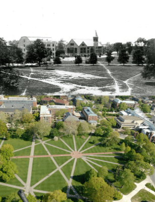
The most exemplary desire path is Ohio University. The pavements were only build after the desire lines were created.
Short history of desire lines
Not all desire paths are upheld though. In Europe the Romans build their road network based on the existing “infrastructure”. Basically the shortest option between point A and B. However, and a huge one, also safety was important. Back in the day dangerous animals roamed around, they were only driven out (read: made extinct) in our regions later. Another key factor were rivers. Many of our town, village, city names are derived from old languages, mainly Celtic for places where rivers could be crossed more safely. Most place names refer to water but that may not surprise you as you will know how the Dutch have mastered themselves in battling the sea from devouring the land. That is the reason why the Lowlands have not been permanently settled for quite a long time. Most of the cities and villages in Belgium and the Netherlands were only documented since the Roman era. The Celts did not leave any written legacy. In the Netherlands 4 places claim to be “the oldest city”. As per usual, it depends on what definition of “city” is used. Comparable to why many countries have several “oldest pubs”. Most roads that were created by the Celts and paved by the Romans are still in use. Some cities have faded away though or have become less important.
In Belgium specifically our first city with a golden era was Bruges. Many people will have visited the medieval city also known as one of the many self-proclaimed “Venice of the north”. Bruges created many ports and canals to sustain their position but eventually lost due to silting. Antwerp took over for a short while but the Eighty Year’s War gave the title to Amsterdam. Water has been a major factor in the Lowlands.
A perfect example of not upholding historic desire lines is Belgium’s third railway line connecting Antwerp and Rotterdam. When the railway line was planned (about 1852, not long after Belgian’s independence) both nations wanted the line to go through Breda. One rich fellow changed the future for several towns and decided to build the line on most of his own lands between Antwerp and Roosendaal. This resulted in less expropriations and thus faster realization of the project. Some towns were not serviced with a station and remained dormant, while others boomed. Oh, and for quite some time the train was loaded onto a ship since the river (Hollands Diep, lit: deep) was deemed to wild to build a bridge.
About fifteen years ago a new line was opened between Antwerp and Schiphol (Amsterdam Airport). Fascinatingly this one does follow the Roman road more. The reason was predominantly outdated infrastructure or not suitable for high speed trains. Read: the village were built very close to railways and trains were not allowed to exceed speed limits Practically making the high speed trains drive at snail pace for most of the journey.
The blue line indicates the actual Roman road from Antwerp to Breda. Beware this will probably not show up on a map of Roman network. It concerns a smaller, read: less important connection between the cities. Also note that the whole region of west North Brabant up to Antwerp was inhabited but quite deserted due to restricted accessibility most of the year. Antwerp and Bergen op Zoom also have a Roman connection.
So, the reason to plan the railway line through a town called Essen, changed its future drastically. Due to the location, also being the only border crossing by rail for a very long time, meant quarantine. From French for 40 days as you may remember from a certain pandemic. Nowadays the village still has those “quarantine stables” where cattle was kept until safe to travel/cross the border.
You can only imagine how different many villages would have been if the desire paths were not altered by a wealthy man with plan. Oh, he was certainly not altruistic. He owned very much land and sold off sand (dunes) and other natural resources. The sand he sold was also used to build Antwerp Central Station. If you have read any of my hiking trail summaries you might remember the Belgian side of Grenspark Kalmthoutse Heide is significantly more flat than just across the border.
Well, when a road is created, how nonsensical, unnatural (to humans) or artistically, why would you disturb nature (especially fauna and flora)? To save time while you unwind or de-stress?
Is it a real/serious problem?
In many parks desire paths were seen as an acceptable problem. However since the pandemic many people went hiking as was the only excuse to leave the house. Sometimes wild grazers create these desire lines but people appear intrigued by these and their inner trailblazer awakens.
People are oblivious (or unaware?) of the existence of ground nesting birds or the presence of fawns. Yes, some areas have signposts indicating not to pass through certain areas, but hey, who are we to tell them how to entertain themselves?
Local park rules are always directing people to stay on the path. Therefore now areas must be fenced off endangering wildlife even more (talking about lose-lose situation). Often accompanied by “no access” or “restricted area” signs but those are often blatantly ignored. The most accurate solution is to plant buckthorn (Hippophae rhamnoides), not sure where the English name comes from but in Dutch we call it “dune thorn”.
Yes, it is a real problem. Why do people believe their actions are not harmful? Is it the same reason why people offend laws in traffic as they perceive it as not that problematic? I am referring to someone temporarily parking where it is not allowed or blocking the road to quickly go to the shop… It is a mentality problem. A lack of basic respect for nature, for creatures that cannot defend themselves.
Do you remember how a society is measured? By how it treats its weakest members. Now reflect how you treat those (human, animal or plant) that do not benefit you?
End of the signle way trail at Pluto information sign (the gate fences off Dutch military domain)
Wouwse Plantage start/end point
Their own website is Dutch language only (but contains more details, not sure how well AI will translate though): https://www.pinsplanetenpad.nl
The official website starts with a warning:
The trail is not a loop. Similar to the solar system, it ends far away from the starting point. Single way is 8.2km (5.1mi) through woodlands. Th route back is another 8km (4.9mi).
After the hike I noticed I had missed one planet. Yes, the one that is joked about most. In my defense, as you get away from the sun, the distance between planets increases significantly. Depending on your focus, or perhaps natural circumstances (I hiked portions of this trail before and a fallen tree obscured the Mars information sign), or that these signs blend into the background easily, might all be contributing factors. When checking the location of Uranus (the sign), I did notice forest management works being carried out in that specific area. Anyways, a good reason to hike the trail again in wintertime? So to compare the seasonal changes? Am I really looking for excuses to walk it again?
For some reason the slideshow does not reflect the logical order of the planets as I shuffled them.
On the trail is just one small camping place (brasserie/pancake house) so better check opening hours if you don’t bring provisions.
Quite a lovely hike mostly through woodlands and crossing a few roads. One section was obviously less trodden. I hiked on a weekday when school had already restarted for the local youth.
On the top left you can see Bergen op Zoom. The military domain (landing strip) is blurred and fenced off and guarded by canines as signs indicate/warn. De Zoom on the right hand side is a peat canal which was completely dried up. The canal brought peat from Kalmthoutse Heide region to Bergen op Zoom in the olden days. Nowadays it is a splendid bike/hike path.
Perhaps worth mentioning that the soil can be quite hard in summer although the path was repaired on some sections and then it’s basically loose sand. In Dutch we call it calves biters (muscles) however no English equivalent seems to exist. During all other seasons appropriate shoes are recommended. Quite certainly gaiters are no luxury.
I have been wondering why people create shortcuts in nature. Instead of following the path they walk over vegetation. Why would you even consider doing that? Are you really in a rush when searching for peace and quiet? A toilet? Should everything be fenced off where to walk and where not? I just do not understand this behavior in nature. To point out just one advantage of not walking off trail, less chances to gather ticks.
Then I found some interesting results and even psychology behind it all.
In cities people are oftentimes (read: always) in a hurry. Cities equal time = money.
A desire path or desire lines have a very long history.
Animals create these lines as well. You will probably have seen the paths created by hippo’s, (or elephants or cattle). Funny how the English language still holds on to the Latin word (‘river horse’). If you wonder where behemoth comes from, well, it’s the Russian version. In Germanic languages it got translated into “Nile horse” and South Africans call it a “sea cow” (not sure if “sea horse” was already taken).
The hippo trails had a specific purpose.
Back in the day, like centuries, people took the paths with least resistance. In my region a new church was built because people of a nearby municipality had to walk 7 or 8 miles to the nearest church. Oh no, not the distance was the problem but wolves. And then I wonder how many proud parents and babies got attacked before the Catholic church decided to protect the parishioners. In the 16th to 18th century wolves were hunted nationwide. Only now they are slowly returning into some regions thanks to the protected status of wolves.
In Europe, many places near rivers have names that nowadays translate into “shallow place to cross river”. In Dutch language you will often hear/read place names ending on -voorde, -foort or -drecht, -dracht, -trecht, , -tricht, -tracht or wad (like the Frisian Islands north west of Amsterdam and are dotted along the shoreline over Germany to Denmark, those islands are worth a story on itself). In Germany you will notice plenty of -furt (Frankfurt) or -ford in English (Stamford, Oxford). Yes, it is derived from the Nordic fjord.
The first roads were actual desire paths. The safest, shortest, easiest way to go from point A to B. Much depended on the environment. Obviously, back in the day, safety was rated more important than shortest. You rather want to reach your destination than be earlier with a risk of Russian roulette or knee-deep covered in mud. It was only when the Romans started building their roads, for military purposes primarily, of course, that cities became more easily accessible. Civilizations before the Romans already had roads so the Romans did not have to do much more in the department of planning. That Roman network is actually still in use. Not all of the cities are still that important and certainly bigger cities exist that were hardly villages in the Roman era but it might provide an indication why European road network is not as organized as in the USA. In the US settlers could basically start from scratch. Hence why you will not easily find numerical street name in Europe.
Street, roads, etc were named geographically. The main hiking trails are often a description of the area or the destination (pilgrimage), etc. People used to walk longer than we have motorized vehicles. And yet, I am so surprised people hike in nature with white sneakers. You must remain classy and elegant for wildlife, right?
Also, interesting is why the Romans called the Irish “Scotti”. Did the Romans not call Ireland “Hibernia”, land of winter? It were certainly not just the Normans who marketed their new territories ‘Ice’-land and ‘Green’-land for no reason whatsoever. Funny and fascinating how we are still unclear about so many names and etymology.
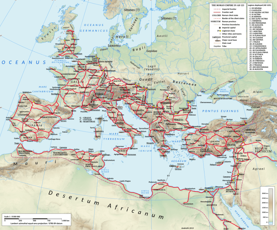
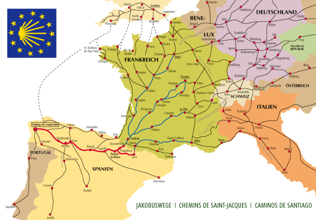
For Americans the most well known desire path is Broadway (aka Wecquaesgeek trail). In Europe I assume we have to look towards the famous Camino de Compostela.
Are you surprised the Camino Francés (The French Way) is more than 1000 years old?
I just realized only one route is listed on the map above. In Belgium alone we have eight major ones, even more if you count “shortcuts” to current public transport, mainly linking up to railway stations. From left to right: Via Yprensis (Ypres), Via Brugensis (Bruges indeed), Via Scaldea (river Scheldt), Via Tenera (Latin version of Celtic ‘Tanare’ = dark water, follows the river Dender), Via Brabantica (through Duchy of Brabant), Via Lovaniensis (through Leuven; university city and home of Anheuser-Busch Inbev HQ), Via Monastica (even more monastic POI on route, those familiar with abbey/trappist beers and cheeses: Postel, Tongerlo, Leffe, Averbode) and finally Via Limburgica (most Belgians don’t appreciate the area or people with the respect they deserve, but hey, their loss, right). Obviously all the routes are a string of monastic/religious places. Nowadays you can also bike the compostela.
It is quite amusing when Americans come to Europe and are surprised by how small everything is. Perhaps not realizing it – sort of – naturally evolved. Cities are centuries old and cannot easily be dismantled to accommodate to modern traffic. Therefore many major cities are banning motorized vehicles from city centers. Also focusing on public transport. Why not question the reasoning behind US city not being able to implement more eco-friendly transport options? Some cities are car-free, some have low or zero emission zones. Why rent cars and – besides not understanding every European country has its own traffic rules – don’t know many areas are not accessible by car.
Some examples show insights as Ohio State University. only when the desire paths became obvious they paved the way.
Sometimes authorities even legalized cases whereby locals painted pedestrian crossings (in Dutch zebra path; BE: zebra crossing). And because of their success, authorities made them official.
In nature straight lines are not common. To avoid danger (water crossing, wildlife, or treacherous areas) routes were rarely direct lines.
It were the Romans that started straight roads. Probably they also had the notion that curves and corners meant waste of time. Before Roman roads travel was extremely adventurous. Pretty unimaginable for most of us nowadays. Certainly since our parks are often cleaned up for aesthetic reasons. Luckily most do understand that death is life. Like death wood is a life source for many bugs, the bugs attract birds, etc.
Walking distances would vary significantly. Most hikers will consider plenty of factors to estimate pace or distance. History learns us that Harold Godwinson won a war in the north. Moved south to deal with Norman invasion, meaning 200mi in a week (abt 27mi/d). This was well after the Romans built their network but I assume one thousand years ago they did not have the best of footwear.
On the other hand water also finds the path of least resistance and changes trajectories. Human activities does not follow nature’s pace of life. Then again, water can carve out mountains.