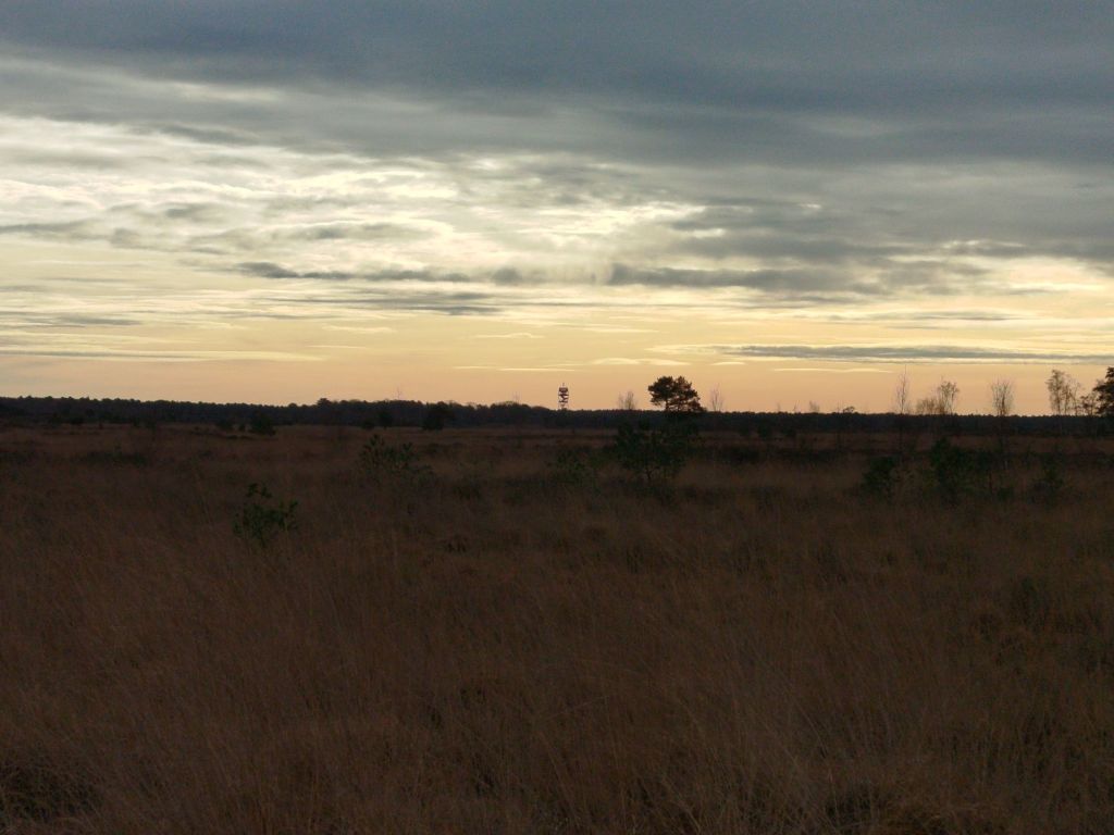
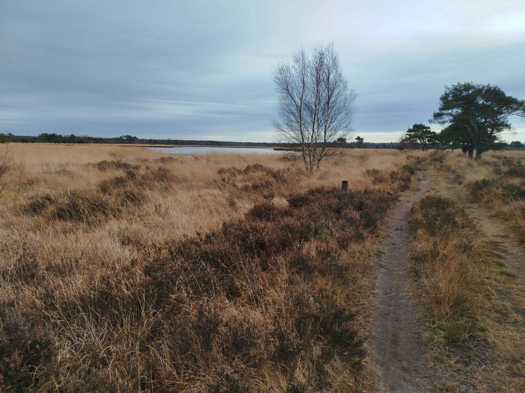
Early to half December and I was hiking in a shirt. The fens were about as dry as during high summer. Groundwater levels still need plenty of rainfall.
The construction in the center is an observation post (locally known as fire tower). At almost 140ft high two platforms (40 and 80ft) are open for public. The top floor is reserved for volunteer observers and equipment. Earlier this year cameras have been installed with AI to detect wildfires at the earliest stages as far as 20mi away.
Can you tell Vincent van Gogh was from this area? Or is it my imagination linking the Dutch painter to this natural phenomenon. If Vinny was still around it might even be attributed to him. Like Banksy’s being created overnight. Surely pumpkin spice is not that popular in the Lowlands, is it?
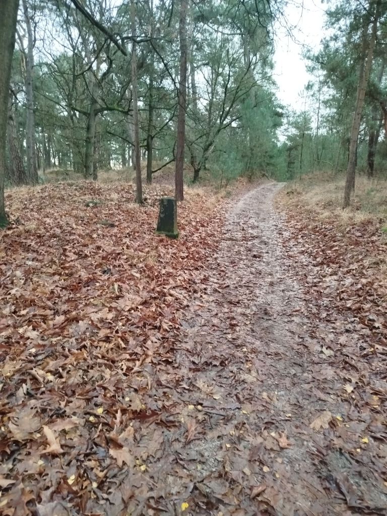
I walked a portion of the border. These old, stone border markers are still present.
The newer ones are painted black and white and have a date (1843) and number on them. This path was probably created by border patrol. On some sections left and right aligned with barbwire (some are either private property, hunting grounds or to protect vulnerable areas). Obviously smugglers would not “walk the line”. In order to preserve nature, walking the pathways is mandatory. If you desire to rebel, have the balls to punch up, not down!
This specific fen (Kriekelaarsven – Bird-Cherry Fen) used to be much larger.
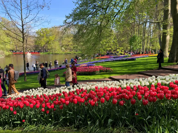
Tomorrow I plan to hike the three largest fens in the park to document the water levels. Stappersven, almost identical in English so I assume you can deduce, is the largest and on my last visit, you could walk about 30ft from the shoreline without getting wet feet. The other, Putse Moer (Marsh of Putte, which is a place name) was partly dried up. The third is Drielingvennen/ Klein Moerken which translates as Triplet Fens or Small Marshy. It consists of three separate fens that often become one large fen.
Human logic or perceived common sense always leaves me baffled. I guess everyone has encountered one of those moments at least once a week, or perhaps daily if you participate in traffic.
I am all but surprised of people escaping the rat race. In public the law of the jungle seems to prevail over basic humanity, a bare minimum of respect and even traffic laws don’t seem to apply to some. Or do I attract these idiots?
For some reason a road users hierarchy is still prevalent, just like in society unfortunately. If you drive a small car you will have experienced the arrogance or even law breaking bigger or more costly cars. The “food pyramid” of the traffic hierarchy is not completely representative as the top tier often do respect vulnerable road users more than any other motorized vehicle. Yes, I understand this is a generalization and not all luxury car owners are road ragers.
For some reason I detect a difference between the top image as being more European and the bottom the US variant. Our roads were present long before cars or even carts were invented. Hence the reason why many streets are now “cycling streets”. Cars are allowed but cannot pass cyclists. These streets are often around schools or streets that are no longer regarded as collector roads. These “cycle roads” are deemed surplus (other options available nearby for cars where they can drive faster more safely).
Hiker rules
Furthermore am I surprised many people don’t know about basic rules for hiking in their own country. In Belgium, if no sidewalk/pavement is present, you have to walk on the side of oncoming traffic. It is safer and less chances to be startled by cyclists passing by in stealth mode (nowadays even electric vehicles). Many people desperately hold on to the “always keep right” mantra. I often walk around oncoming dogs (and their owners) as I understand all too well it is not the dogs fault they were raised like that. On many occasions my swerve caused dangerous situations although mostly jump scares (for me). Whilst dog owners practically enjoy and laugh about the situation. I am usually to stunned to explain their wrongdoing. In most cases these people are not even aware or deemed trivial. In the Netherlands the law stipulates or concentrates on safety. If the road curves, take the outside lane for best overview. For a hiker this means crossing the road often. Seasoned hikers predominantly opt for the left side of the road. Dutch organized walks prefer left when outside town/city centers. Since Dutch traffic rules changed about thirty years ago, in favor of safety, most hikers are advised to chose the left. Also, in the Netherlands the preferred side is based on where the street lights are located.
Both laws have their advantages and disadvantages, when crossing the border as much as I do on my hikes, I learned to switch traffic laws practically automatically. Unfortunately some people (from both sides of the border) believe their nations/local laws also apply in the other country. Comparable to (some) US citizens believing their constitution is universal. Yes, those vids are hilarious. Speed limits between both countries differ maximum 13mi/h (20km/u). However it makes a huge difference when in a town/city center when max speed is 19mi/h (30km/u) or 31mi/h (50km/u). Traffic laws are subject to change more than people tend to believe. If you live in a border region it is best to be aware of the neighboring laws and customs. The animosity is often palpable. Quite surprising since the border is only in effect for less than 200 years. Before that we were one nation for centuries. Then again, stupidity is limitless. As a Belgian I am more at ease in the Netherlands on bike and hiking. In Belgium it largely varies from region to region.
For US citizens, there is no such thing as jaywalking in most European countries. Basically every road is permitted to hike and bike on except highways. Perhaps I also need to specify some roads (especially in Belgium) might initially have bike lanes but mysteriously vanish after a while. Not going to try explain Belgian politics but basically responsibility for the roads is shared on several levels. One community might implement cycling infrastructure while the next village does not.
Desire paths/lines
Until recently I used the English version of the concept as I was unable to find a Dutch alternative. Whilst studying those desire paths I learned animals made such lines trekking from one area to the next. Usually the path of least resistance. Same for humans although not always…
In Dutch it is called (literally) an elephant or goat’s path or bevel (no links to Dutch meaning) or something like a cut offy like in a shortcut.
Most of these created by humans is to save time or not to reduce speed when cycling and an obstacles is placed to… reduce speed. In some cases bike lanes have strange curves. You can only wonder if there was once an old protected tree. The example below is quite indicative. Especially since a lot of school kids use these paths frequently and they often travel in herds. It also shows how impatient the world has become.
More surprising is the photo below. Is it really shorter or safer? Depending on the region the desire path is even causing dirty shoes for the majority of the year.
Is the little shuffle too much exercise? I cannot fathom why a stroll in the park is causing this desire line. A walk in the park is too complicated?
The most exemplary desire path is Ohio University. The pavements were only build after the desire lines were created.
Short history of desire lines
Not all desire paths are upheld though. In Europe the Romans build their road network based on the existing “infrastructure”. Basically the shortest option between point A and B. However, and a huge one, also safety was important. Back in the day dangerous animals roamed around, they were only driven out (read: made extinct) in our regions later. Another key factor were rivers. Many of our town, village, city names are derived from old languages, mainly Celtic for places where rivers could be crossed more safely. Most place names refer to water but that may not surprise you as you will know how the Dutch have mastered themselves in battling the sea from devouring the land. That is the reason why the Lowlands have not been permanently settled for quite a long time. Most of the cities and villages in Belgium and the Netherlands were only documented since the Roman era. The Celts did not leave any written legacy. In the Netherlands 4 places claim to be “the oldest city”. As per usual, it depends on what definition of “city” is used. Comparable to why many countries have several “oldest pubs”. Most roads that were created by the Celts and paved by the Romans are still in use. Some cities have faded away though or have become less important.
In Belgium specifically our first city with a golden era was Bruges. Many people will have visited the medieval city also known as one of the many self-proclaimed “Venice of the north”. Bruges created many ports and canals to sustain their position but eventually lost due to silting. Antwerp took over for a short while but the Eighty Year’s War gave the title to Amsterdam. Water has been a major factor in the Lowlands.
A perfect example of not upholding historic desire lines is Belgium’s third railway line connecting Antwerp and Rotterdam. When the railway line was planned (about 1852, not long after Belgian’s independence) both nations wanted the line to go through Breda. One rich fellow changed the future for several towns and decided to build the line on most of his own lands between Antwerp and Roosendaal. This resulted in less expropriations and thus faster realization of the project. Some towns were not serviced with a station and remained dormant, while others boomed. Oh, and for quite some time the train was loaded onto a ship since the river (Hollands Diep, lit: deep) was deemed to wild to build a bridge.
About fifteen years ago a new line was opened between Antwerp and Schiphol (Amsterdam Airport). Fascinatingly this one does follow the Roman road more. The reason was predominantly outdated infrastructure or not suitable for high speed trains. Read: the village were built very close to railways and trains were not allowed to exceed speed limits Practically making the high speed trains drive at snail pace for most of the journey.
The blue line indicates the actual Roman road from Antwerp to Breda. Beware this will probably not show up on a map of Roman network. It concerns a smaller, read: less important connection between the cities. Also note that the whole region of west North Brabant up to Antwerp was inhabited but quite deserted due to restricted accessibility most of the year. Antwerp and Bergen op Zoom also have a Roman connection.
So, the reason to plan the railway line through a town called Essen, changed its future drastically. Due to the location, also being the only border crossing by rail for a very long time, meant quarantine. From French for 40 days as you may remember from a certain pandemic. Nowadays the village still has those “quarantine stables” where cattle was kept until safe to travel/cross the border.
You can only imagine how different many villages would have been if the desire paths were not altered by a wealthy man with plan. Oh, he was certainly not altruistic. He owned very much land and sold off sand (dunes) and other natural resources. The sand he sold was also used to build Antwerp Central Station. If you have read any of my hiking trail summaries you might remember the Belgian side of Grenspark Kalmthoutse Heide is significantly more flat than just across the border.
Well, when a road is created, how nonsensical, unnatural (to humans) or artistically, why would you disturb nature (especially fauna and flora)? To save time while you unwind or de-stress?
Is it a real/serious problem?
In many parks desire paths were seen as an acceptable problem. However since the pandemic many people went hiking as was the only excuse to leave the house. Sometimes wild grazers create these desire lines but people appear intrigued by these and their inner trailblazer awakens.
People are oblivious (or unaware?) of the existence of ground nesting birds or the presence of fawns. Yes, some areas have signposts indicating not to pass through certain areas, but hey, who are we to tell them how to entertain themselves?
Local park rules are always directing people to stay on the path. Therefore now areas must be fenced off endangering wildlife even more (talking about lose-lose situation). Often accompanied by “no access” or “restricted area” signs but those are often blatantly ignored. The most accurate solution is to plant buckthorn (Hippophae rhamnoides), not sure where the English name comes from but in Dutch we call it “dune thorn”.
Yes, it is a real problem. Why do people believe their actions are not harmful? Is it the same reason why people offend laws in traffic as they perceive it as not that problematic? I am referring to someone temporarily parking where it is not allowed or blocking the road to quickly go to the shop… It is a mentality problem. A lack of basic respect for nature, for creatures that cannot defend themselves.
Do you remember how a society is measured? By how it treats its weakest members. Now reflect how you treat those (human, animal or plant) that do not benefit you?
From point A to B. How did the Dutch language (or most Germanic languages) get their names for their mishmash of ways ?
In the lowlands most villages were named after their geo locations. Since villages/communities rose near water sources, most names can be retraced to Celtic, Germanic or Roman words for marshlands, shallow area to cross river, elevated area next to river, and the likes. Depending on when a village was founded or recognized. The same suffixes may pop up in different regions. For example Woensdrecht and Maastricht both were founded because you could (often) safely cross the river at that point. However these are located in opposite ends of the Netherlands. Maastricht was a placed to cross the river Meuse and Woensdrecht to cross the Scheldt and (most probably but debated) refers to Germanic god Wodan. Like Wednesday in English is Woensdag in Dutch and both are presumed to be dedicated to the Germanic deity.
The -trecht, -tricht,- drecht, -dracht always refer to the same. Dozens of such suffixes exist.
To link up communities paths were created. Please note that these paths were created long before the Roman era or even before the invention of the wheel. I have to admit that my region was not continuously inhabited because of the nearby river Scheldt. Frequent flooding made the area too dangerous to live. And people were not forced to live where danger lurked. Some people do live voluntarily in dangerous areas, like Naples (Pompeii is nearby), since the soil is very rich and their fruit and vegetables very tasty. Basically all of current Belgium and Southern part of The Netherlands were largely ignored due to (often infertile) marshlands for quite some time.
Road: from Proto-Germanic raido and basically from ‘riding’. In Dutch we don’t use this word or derivations. In Dutch “baan” is the most accurate equivalent in the meaning of free/safe passage. The Dutch language has a saying “zich een weg banen” meaning to create/pave a way. No direct translation there unfortunately. Also in sports the Dutch language use “baan” like a sports field/court in tennis, cycling, ice-skating, gof, etc. The Dutch also use “baan” for a job and that comes from ice skaters that preferred ice rinks because they were too scared of natural ice. When they went to skate/ride on the ice “baan“, the term “baantje trekken” was used. In Dutch maritime jargon “baantje” (lit: little job) was applied for less strenuous and tiring tasks aboard a ship. Nowadays job and “baan” are synonyms.
Boulevard: is an important and broad street derived from, ah oui, la France. However a Middle Dutch word the French bastardized “bolwerk“, yes, recognize bulwark. Initially it meant a fortress. The French appropriated the word and expanded the meaning to include the pathways on the ramparts of the fortress. In the second half of the 18th century the French created those monumental, broad roads towards Paris city center and called them boulevards. The Dutch in turn now also use the the word to describe a road. Obviously the Dutch no longer understand the link between their “bolwerk” and boulevard.
Drive: a broad, rural road. Originally a road where cattle was driven. Originally from Old High German. In Dutch language we use “dreef“, hence the broader nature of these paths. A Dutch expression goes: “op dreef zijn“, like ‘on the road’ or literally droving meaning you are doing well; or doing a great job. Are you already seeing a pattern?
Canal: Not sure if an accurate English word exists. In Dutch the path next to the canal is called “gracht“. It is closely related to the English grave or Dutch “graven” (to dig). Just like boulevard, the meaning got expanded in this instance to the pathway next to canal. Dutch city Delft is derived from “delven” a synonym of “graven”. If you have visited Amsterdam you will be aware the streets next to the canals have the exact same name (ie Prinsengracht – Prince’s Canal). I would advise not to walk on the wet part of the canal even when overly confident on substances.
Towpath: is related but not exactly the same. In Dutch we call these “jaagpad”. In Dutch you might be confused as we use “jagen” which can also mean to hunt. However in Dutch “jagen” also means to push/pull something like cattle or peat boats.
Court: Original meaning in Dutch is an enclosed area, like the English manors or estates. The Dutch word “hof” has many meanings. Anyone surprised since the word is in use for more than 1000 years? Enclosed area, garden, residence, etc are just a few examples but we also use it for cemetery as ‘church garden’ (kerkhof) or labyrinth as ‘wander garden’ (doolhof). The Dutch meaning and US/UK meaning differ. In the lowlands the court is always fenced off. Usually old castles, manors or estates that have public pathways; be aware some areas are not always public domain (please do respect that so the publicly accessible paths remain public). The best well-known “hof” in the Netherlands is “Keukenhof” but be aware this not a public area (entrance fee).
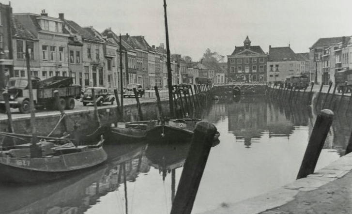
Quay: like Dutch “kade” (verbally “kaai” is more used) means way on embankment/riverside/levee. it is derived from Celtic word for seperation, enclosure and the Dutch equal to “haag“. Over time the meaning has shifted towards loading/unloading area in port. (photo: Bergen op Zoom)
Lane: “laan“, way with trees. Etymology is unclear. Might be from Greek word to tow: “elaúnen“. In that case a lane is a drive or vice versa. In Middle Dutch a lane was a side road, linking up a destination from the main road. I assume that makes it more a driveway. That is how you knew you were on someone’s property, a single line of trees on both sides next to a path. Our modern concept of road with trees is not even that old. When I say not that old, I mean not more than 1000 years, just as context “when a European says not that old”.
Path:pad, small way. Obviously this one is one of the oldest and less easiest to find the origins. Certain is that Germanic languages, Greek, Sanskrit, Persian and others have similar words. Perhaps noteworthy that in Dutch language “wandelpad” (hiking path) is used due to many meanings of the word “pad“. Like toad or Thai dish or even the English meanings for pad have invaded our language.
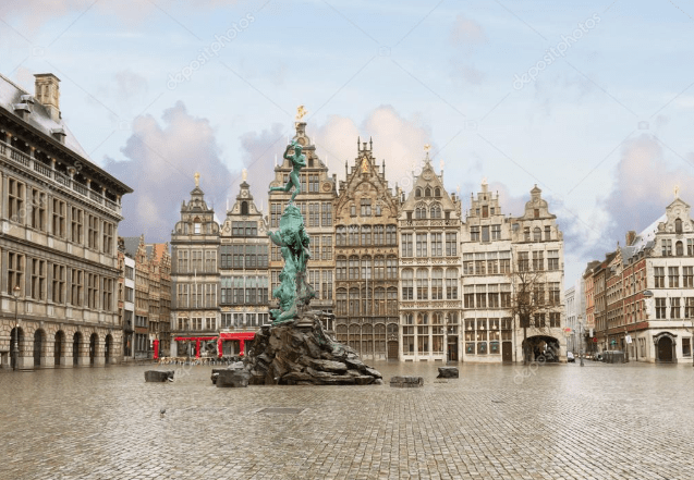
Place: “plaats” loan word from Old French “place“, which means spot or area. From Latin “platea” broad street or courtyard, which was taken from Greek “plateia” flat, broad and spacious. A place is literally a flat area/space. (photo of Groenplaats, Antwerp)
Plain (Square/Circus/Place): “plein” in Dutch. Open area in built-up area. From Middle French “plain” from Latin “Planum” meaning surface or area. In Dutch evolved to open area in city. In Middle Dutch “plaetse” was used, here I do hear some Spanish influence “plaza”. (photo: Grote Markt Plein, Antwerp)
Singel: idem in Dutch, or circular/ring road or stadsgracht (city canal). Originally singel meant borderline. In Old French it means city enclosure. Ancient Dutch cities predominantly had canals to protect. Hence the Dutch synonym for city canal. (photo: Amsterdam Singel)
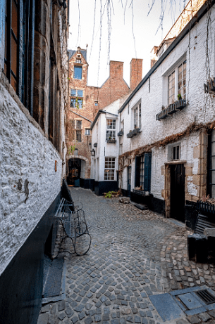
Alley(way): “steeg“, small (side) street. The word is literally derived from “stijgen“, to mount as the alleyways climbed up from the canals to the dike. Originally from rural areas but over time a more frequent name for small side streets in city or village. In Flanders also called “gang” as in hallway, passage or corridor. (photo: Vlaaikensgang, Antwerp)
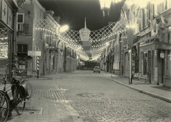
Street: paved way. Derived from Latin “via strate“. Conjugation of “sternere“: pave, spread and straighten. In the early days streetway was used but way was dropped. In Dutch we also say sea-street but then it is derived from English strait in the meaning of small passage. (Reigerstraat, Breda)
Way: “weg“, path or street. Origins are in Indo-European for riding/driving or transporting. In the Dutch “bewegen” (to move) includes “weg” for a reason. Hence the definition of route on which people travel.
I am actually quite happy with so many styles of ways. Except for motorways/freeways pedestrians can walk on all public ways. I would certainly advise against using Komoot as it sends cyclists and hikers over regional roads that are basically motorways. Legally cyclists and hikers are all allowed. Common sense however, which certain apps do not have, might send you over locally infamous death roads. Also car dependency is not the way forward. If you want to live in the middle of nowhere, expect solitude.
It fascinates me that in English some definitions are regulated. And then again the Commonwealth uses “close” for cul-de-sac whilst US have dead ends. Funny how the English don’t translate the French word bottom o/t sack or Tolkien’s Bag End.
Road (Rd.): Can be anything that connects two points. The most basic of the naming conventions.
Way: A small side street off a road.
Street (St.): A public way that has buildings on both sides of it. They run perpendicular to avenues.
Avenue (Ave.): Also a public way that has buildings or trees on either side of it. They run perpendicular to streets.
Boulevard (Blvd.): A very wide city street that has trees and vegetation on both sides of it. There’s also usually a median in the middle of boulevards.
Lane (Ln.): A narrow road often found in a rural area. Basically, the opposite of a boulevard.
Drive (Dr.): A long, winding road that has its route shaped by its environment, like a nearby lake or mountain.
Terrace (Ter.): A street that follows the top of a slope.
Place (Pl.): A road or street that has no throughway—or leads to a dead end.
Court (Ct.): A road or street that ends in a circle or loop.
Of course, these are more guidelines than hard-and-fast rules, and not every city in the world follows these naming conventions exactly. Also, they tend not to be as strict with these in suburbs and newer areas: sometimes a street is called a “lane” simply because an urban planner or developer might think it sounds nice. (source: https://www.mid-americantitle.com/local-news/streets-ave-court)